By Sault Tourism


How to Experience one of Ontario's best lookout hikes

Robertson Cliffs, just 30 minutes north of Sault Ste. Marie, is one of best lookout hikes in Ontario. These cliffs offer views from several incredible lookouts that stretch for miles across Bellevue Valley towards the Goulais River and as far as Lake Superior. 

The cliffs are owned and cared for by Algoma Highlands Conservancy, a not for profit organization that is run by local volunteers. Clearly marked trails are maintained through donations and memberships. To support this organization click here

Robertson Cliffs

Where Are Robertson Cliffs?

AHC’s Robertson Cliffs are located about 30 minutes north of Sault Ste. Marie, just east of the trans-Canada highway, highway 17. Click here for a Google Maps link to directions to one of the car park areas. 

Where Can I park?

There are three parking areas at the trail heads, these are shown in the below maps. 

Robertson Cliffs near Sault Ste. Marie
Road to Algoma Highlands Conservancy towards Robertson Cliffs
Robertson Cliffs near Sault Ste. Marie
One of the eastern parking lots

How Long Does the Hike Take and How Difficult Is It?

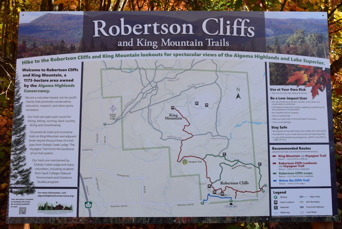
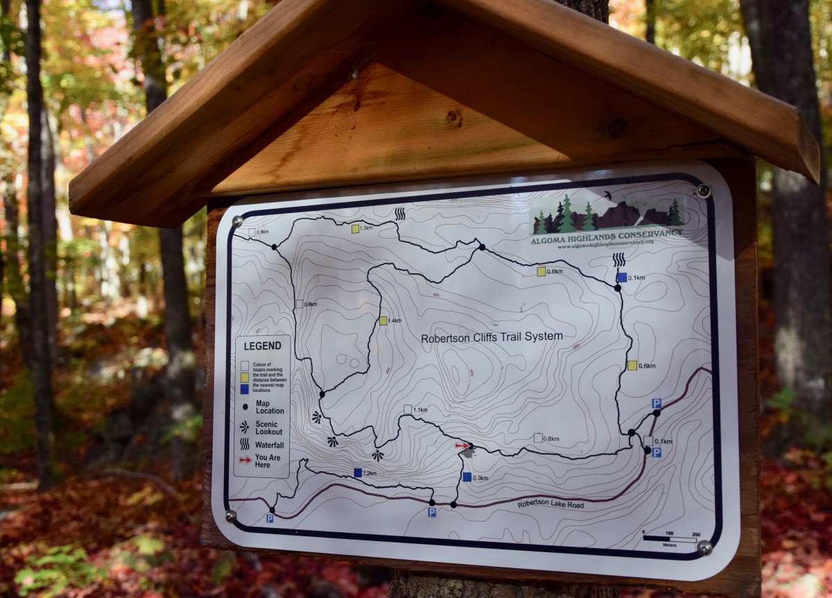
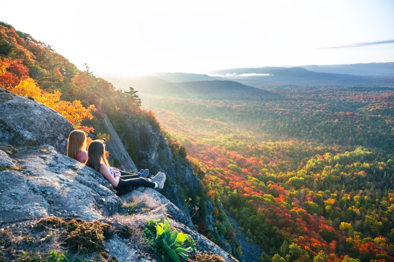
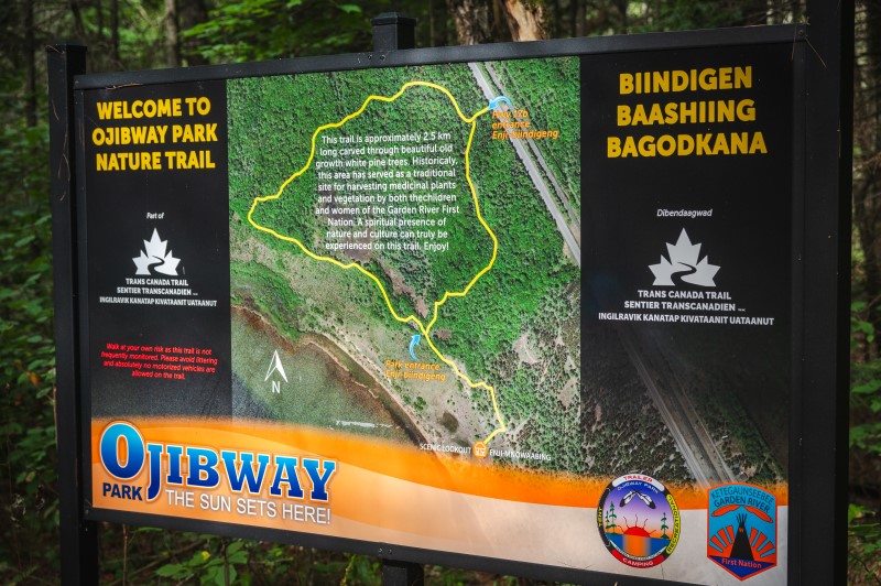
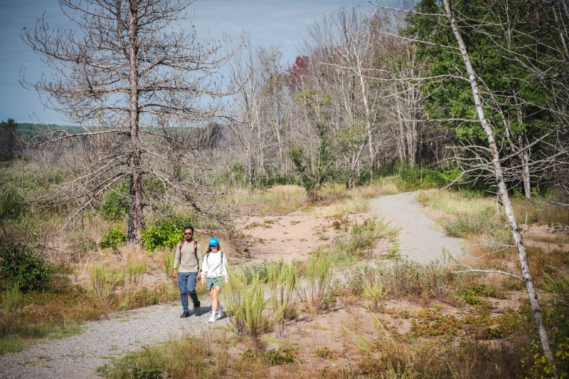
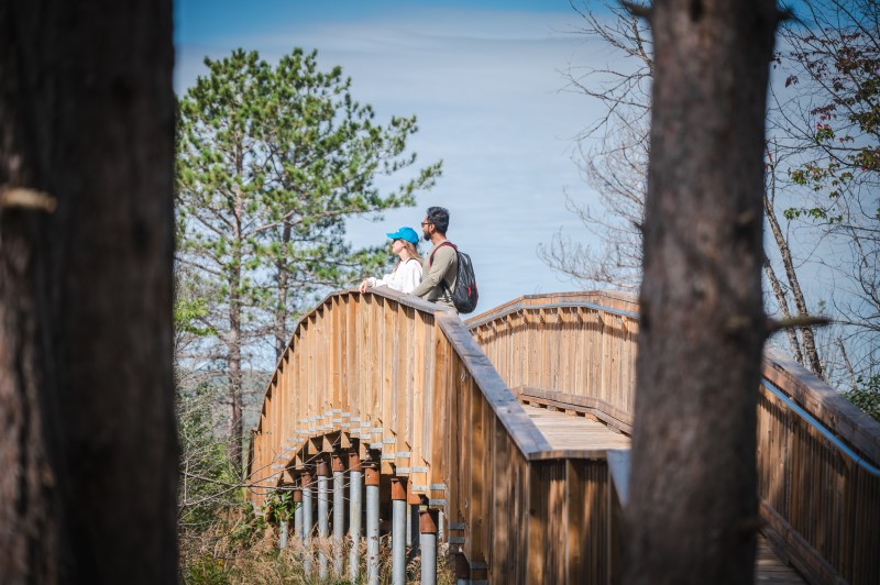
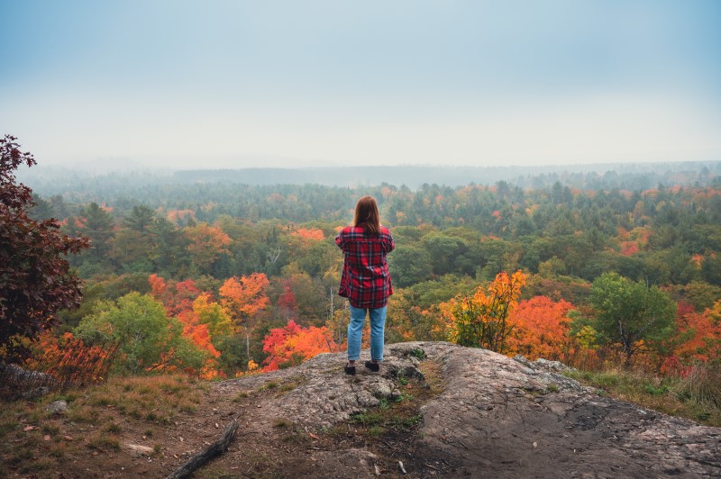
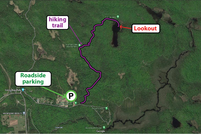
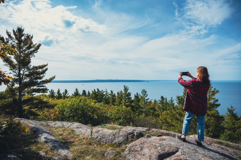
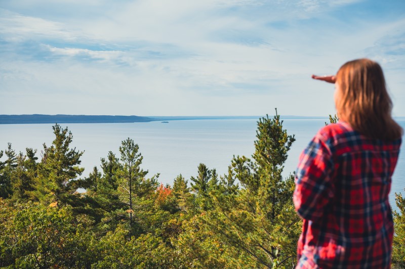
The route to the top can take between 45 minutes and 2 hours depending on which trail you take, and then the same on the way back. So allow yourself at least 2 hours as a minimum.
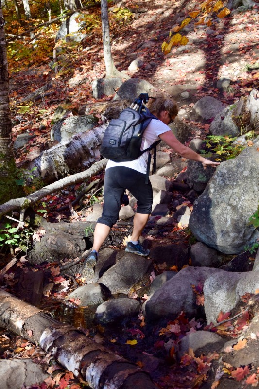
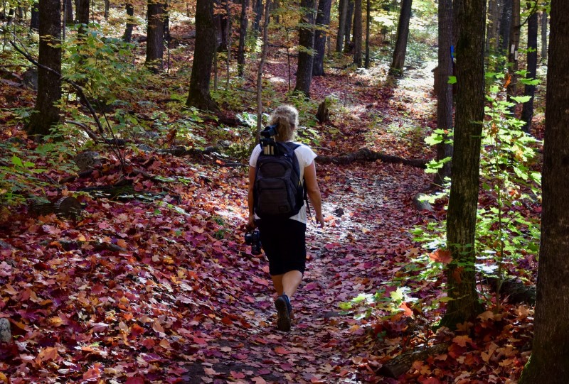
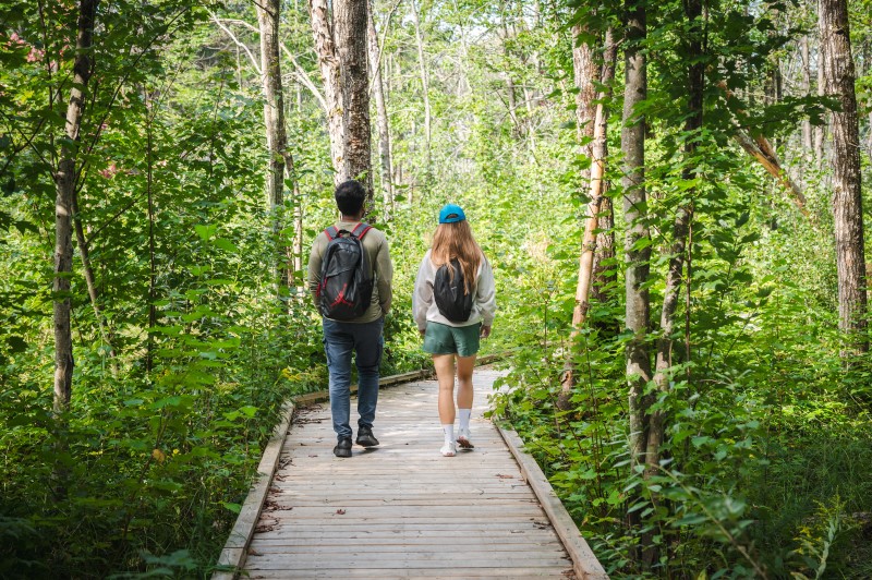
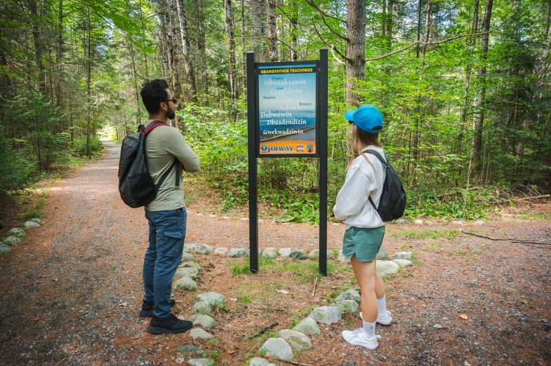
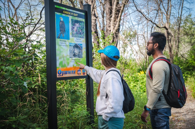
It’s described a ‘moderate’ difficulty because there is some scrambling over rocks, small streams and occasion trees. Click on the below images to see some maps of the area. 

Map of Robertson Cliffs
Map of local area
Robertson Cliffs near Sault Ste. Marie
Crossing a stream
Map of Robertson Cliffs
The trail map, easily found along the routes

What Routes are there and Are the trails well marked?

There are 3 routes that will get you to the top. The Blue route is a 300 metre route that links up with the white route. It begins at the western parking lot. 

The White route is a 2km, 45 minute route which begins at one of the two eastern parking lots. Well marked trails lead through the Great Lakes St. Lawrence forest before meeting up with the blue trail. Once the blue and white trail meet the trail does get a little steeper as it ascends to the lookout points. 

The yellow trail is a longer 2.5km trek that takes you along beautiful waterfalls. Allow 2 hours for this hike to the cliffs. 

Robertson Cliffs near Sault Ste. Marie
White and yellow trail, trail head
Robertson Cliffs near Sault Ste. Marie
White and Yellow routes diverge
Robertson Cliffs near Sault Ste. Marie
The Blue route marker
Robertson Cliffs near Sault Ste. Marie
Hiking through the forest
Robertson Cliffs near Sault Ste. Marie
More route signs
Blue route trail-head

What about the lookouts and what is view like?

There are 3 main lookouts with several others you can find along the way too. The views… judge for yourself. 

Sunrise at Robertson Cliffs
Eastern lookout
Robertson Cliffs near Sault Ste. Marie
Eastern lookout
Robertson Cliffs near Sault Ste. Marie
Western lookout

Are there any Tour guides?

Three awesome local tour guides can show you the way and also give you some stellar insight into the area. Thrive Tours, Forest The Canoe and Blaq Bear Adventures

How Can I Help Maintain this area?

A huge thanks to the Algoma Highlands Conservancy and its volunteers for maintaining these beautiful trails. You can donate or volunteer to the Conservancy here!

Robertson Cliffs near Sault Ste. Marie
Algoma Highlands Conservancy
Robertson Cliffs near Sault Ste. Marie
QR code to donate

By Sault Tourism


explore the natural beauty and cultural significance of the region

The Ojibway Park Nature Trail is a beautiful, easily-accessible, hiking trail located in Garden River, just east of Sault Ste. Marie. This trail offers visitors an opportunity to explore the natural beauty and cultural significance of the region.

The trail, which is a mixture of gravel footpath and wooden boardwalk, leading to a scenic lookout, winds through lush forest and wetland ecosystem, creating plenty of opportunities for getting close to wildlife. There are also interpretive signs and markers that share the knowledge and history of the region, offering a unique educational experience. Keep reading to learn more about this nature trail. 

Ojibway Park Hiking Trail

Where Is the Nature Trail Located?

Ojibway Park Nature Trail is located 20km east of Sault Ste. Marie, in Garden River, on highway 17b. 

Where Can I park?

The parking lot is located just south of highway 17b, on the right as you approach from Sault Ste. Marie and Garden River. 

How Long Does the Hike Take and How Difficult Is It?

The hike is 2.5km if you do the full loop, so leave around 1 hour for it from start to finish. You will be on flat paths and boardwalks the whole way, so it is suitable for hikers of all fitness levels!

Are the trails Signposted?

A large map of the trail system is located at the trailhead, near the parking lot. Shortly after the sign you’ll see a fork in the path to give you the choice of which direction around the loop you want to take. To get to the scenic lookout gazebo, you’ll need to be aware of second T-junction in the trail.

What other information is displayed along the trail?

Along the trail you will come across a number of information signs that speak of the history and cultural significance of the area as well as what wildlife you may see along the way. 

Scenic Lookout Gazebo

The trail ultimately leads to a scenic lookout gazebo, with views over the grassland, beach, the most northerly part of Lake Huron, and with views all the way to Sugar Island in the US. 

Part of the Trans Canada Trail

The trail, built in 2016, is part of the Trans Canada Trail. Get more information, including a link to the map here

Are there any Tour guides?

Two local tour guides can help enhance your experience by giving you cultural teachings, indigenous storytelling, culinary delights and information during the hike. 

Check out Thrive Tours, and Walk Among The Trees‘ websites. 

By Tourism Sault Ste. Marie

check out some of the best hiking trails in ontario

Sault Ste. Marie is the perfect place to visit if you want to enjoy some of the best hiking trail in Ontario. Incredible lookouts, magnificent waterfalls, the rugged Canadian Shield, important historical sites, and clean fresh air with just the sound of the wind in trees or waves on the shoreline… Sault Ste. Marie also has hikes for everyone, so if you are looking for a short, family hike, or a robust multi-day adventure, we’ve got a hike for you! Here are 12 hikes in and around Sault Ste. Marie for you to enjoy. 

Hiking to a lookout

Hikes within Sault ste. Marie

If you are looking to stay within the city limits then check out these three great trails, perfect for a family hike or if you are looking for a less strenuous trail.  

1. The Hub Trail and Fort Creek
  • Length: 2km – 22.5km                          
  • Difficulty: Easy    
  • Must See: Bridges over Fort Creek Conservation Area

If you are looking for a family-friendly hike in Sault Ste. Marie, then the Hub Trail is perfect for you. The trail as a whole is 22.5km of paved path and wooden boardwalk that circles the city.

You can of course choose the section you want to hike and the Fort Creek section is a popular choice for many. The trail takes hikers over three picturesque bridges, where there are lots of opportunity to enjoy the beautiful scenery of the creek below as well as many opportunities to spot all the interesting creatures that live there. Keep an eye out for  hawks, great blue herons, and monarch butterflies. 

Visit this Hub Trail page for more information including a link to a complete map!

2. Attikamek trail and Whitefish Island
  • Length: 1km                          
  • Difficulty: Easy     
  • Must See: The St Marys River Rapids

Choose the Attikamek trail and Whitefish Island trail, part of Batchewana First Nation, for a beautiful and well paced hike within the city limits. Parking and trailhead is located at Sault Ste. Marie Canal National Historic Site and you can access the Island across the locks itself. 

Whitefish Island is a National Historic Site for Canada. It’s also a traditional territory and meeting ground of the Anishinaabe peoples of the Great Lakes due to the abundance of natural resources and fish in the St. Mary’s River. 

This site is complete with an easy to follow trail system marked with informational plaques explaining the importance and historical relevance of the island. These trails will lead you through nature preserves right to the historic fishery of the St. Marys River Rapids.  

3. The Voyageur Trail at the Hiawatha Highlands
  • Length: 20km                          
  • Difficulty: Easy to intermediate    
  • Must See: Crystal Falls

The Voyageur Trail is a public hiking trail consisting of almost 600km of wilderness style trails in Northern Ontario. The Hiawatha Loop (which goes past the stunning Crystal Falls), Odena Loop, Beaver Loop and Mabel Lake Loop make up around 20km of trails in this area.

Lots of information is available on the Voyageur Trail Association website here. With maps of the trails at Hiawatha here. In addition all the maps are available via the Ondago App.

4. Ojibway Park Nature Trail
  • Length: 2.5km                          
  • Difficulty: Easy 
  • Must See: Scenic Lookout Gazebo

Just outside the City limits, but only a 15 minute drive from Sault Ste. Marie is the Ojibway Park Nature Trail, situated in Garden River First Nation. This short but beautiful trail offers visitors an opportunity to explore the natural beauty and cultural significance of the region.

The trail, which is a mixture of gravel footpath and wooden boardwalk, leading to a scenic lookout, winds through lush forest and wetland ecosystem, creating plenty of opportunities for getting close to wildlife. There are also interpretive signs and markers that share the knowledge and history of the region, offering a unique educational experience.

Hikes within a one hour Drive of Sault Ste. Marie

These hikes are perfect for a day or half day of hiking and are within one hour’s drive of Sault Ste. Marie. 

5. Robertson Cliffs
  • Length: 4km – 7km                          
  • Difficulty: Intermediate    
  • Must See: Robertson Cliffs Lookout

This there-and-back trail through the beautiful maple forests of the Algoma Highlands takes you to one of best lookout hikes in Ontario. The trail begins at Robertson Cliffs Road and takes you to three incredible south and west facing lookouts. From there you can continue along and do the Robertson Cliffs Loop, passing a beautiful waterfall loop hike, or head back the way you came. 

The trails are owned and cared for by Algoma Highlands Conservancy, a not for profit organization that is run by local volunteers. To access maps of the trail system click here.

6. Eagle Ridge Lookout at Harmony Beach
  • Length: 3km                          
  • Difficulty: Intermediate    
  • Must See: Lookout over Harmony Beach

A 30 minute drive north of Sault Ste. Marie takes you to Harmony Beach, where you hike to a spectacular lookout, Eagle Ridge Lookout, overlooking Lake Superior. 

This moderate trail is part of the Voyageur Trail System, and maps are available online or as hard copies. Forest The Canoe run guided tours to the lookout, click here for more info!

7. Chippewa Falls 
  • Length: 1km-3km                          
  • Difficulty: Easy to intermediate    
  • Must See: The falls themselves

Chippewa Falls is a 35-minutes drive north of Sault Ste. Marie, parking and trailhead is right along the Trans Canada Hwy. The falls, which are visible from the highway itself, stand 25 feet high. 

The hiking trail offers an easy 2.5km hike to the upper falls, which starts in the parking area and follows the river upstream to the top of the main falls. The path continues alongside the river past the upper falls if you want to explore further.

Chippewa Falls are a stop on the Group of Seven driving tour – the falls and rapids rapids inspired A.Y Jackson’s sketch ‘Stream Bed’. Lookout for a ‘Moments of Algoma’ art easel at the trailhead with more information about the falls and the famous group of artists!

8. Rock Lake
  • Length: 5km                          
  • Difficulty: Intermediate    
  • Must See: The unusual smooth rocks overlooking the lake

An beautifully scenic drive east of the city through the Sylvan Valley, and just north of Bruce Mines, takes you to the Rock Lake trailhead. The Rock Lake trail is a offshoot from the Voyageur Trail system, and end up at a unique, smooth rock-top that feels like it should be inspiration for a Group of Seven painting. 

Theses smooth rocks face north and lookout over Rock Lake, with an array of maple forests beautifully surrounding it. 

9. Edmund Fitzgerald Lookout
  • Length: 13.5km                          
  • Difficulty: Intermediate    
  • Must See: Lookout over Pancake Bay

The Edmund Fitzgerald lookout trail is another trail with a spectacular lookout. This one overlooks Pancake Bay Provincial Park (in which the trail is situated), Lake Superior and even as far as place where the Edmund Fitzgerald ship tragically sunk in 1975.

The trail system has 3 hikes available; 6km, 10.5km and 13.5km, with the latter hikes taking you to waterfalls and the inland Tower Lakes. For further information click here.

Hikes To The Lake Superior Coast

If you are looking further afield and want to take in all that the Lake Superior coast has to offer, then consider these beautiful hikes. 

10. Agawa Rock Pictographs
  • Length: 1km                          
  • Difficulty: Difficult (slippery, steep steps)  
  • Must See: The Sacred Pictographs

At the south end of Lake Superior Provincial Park are the Agawa Rock Pictographs. A clearly marked sign on Highway 17 directs visitors to a parking area at the trail head – map coordinates here.

The Agawa Rock Pictographs is one of the most famous pictograph sites in Canada and is one of the most visited indigenous archaeological sites too. It is a sacred site where generations of Ojibwe have come to record dreams, visions and events. Please respect and preserve the pictographs by not touching the paintings.

11. Lake Superior Coastal Trail
  • Length: 65km                          
  • Difficulty: Difficult    
  • Must See: The Rugged Beauty of the Big Lake

For those seeking true adventure, consider this spectacular and rugged coastal trail. It extends from Agawa Bay in the south to Chalfant Cove just north of Warp Bay in the north and will give you a true experience of Lake Superior. Local experts recommend taking 5-6 days because many sections require climbing over rocky headlands and cobble beaches, which can be technically challenging and require a steady pace for safety.

There are various spots for beach camping along the trail; you’ll enjoy incredible coastal scenery during the day and perfectly dark starry skies from your beached-down tent at night. For further reading, click here.

12. Nokomis Trail
  • Length: 3.8km                          
  • Difficulty: Intermediate    
  • Must See: Lookout over Old Woman Bay

The Nokomis trail is a 3.8km  round-trip lookout hike to overlook Old Woman Bay, in Lake Superior Provincial Park. 

The trailhead is across the road from Old Woman Bay Beach parking, and the trail itself takes around 2 hours, with breaks to enjoy the incredible views!

Other Hikes

Sault Ste. Marie and the Algoma District has countless hiking trails. Others include Gros Cap, Wishart Park and Odena Lookout, all within the Sault Ste. Marie city limits. King Mountain is a great hike and can be reached by continuing your route past Robertson Cliffs. The Orphan Lake trail, in Lake Superior Provincial Park is popular in the summer and fall. The ‘Park’ also has many side-trials as well as the larger coastal trail, mentioned above. 

Do you have any other hikes in the area that you particularly enjoy? Tag us in your social media photos #outsideofexpected or our account handles @sault.ste.marie for Instagram and @saulttourism for Facebook. Happy hiking!

By Sault Tourism

Fall Rendezvous Festival, at the Ermatinger Clergue National Historic Site, is a 4-day event, hosted each September by the Friends of Ermatinger Clergue National Historic Site. The festival, this year occurring September 25th – 28th, is a chance to immerse yourself in the history of the war of 1812 and the daily life of the early 1800’s, through a number of live reenactments including; canon and musket fire, Indigenous storytellers, workshops and more!

Keep reading to learn more about the Fall Rendezvous Festival.

Fall Rendezvous Festival

Four Days of Festival

The Fall Rendezvous Festival starts on Wednesday, September 25th and will run for four days until Saturday, September 28th, 2024. The event is open to the public, as well as for groups including School Groups, from 10am to 4pm for each day. 

Admission is by donation (pay what you can) and includes entrance to the Ermatinger Clergue National Historic Site heritage buildings and grounds, as well as interaction and knowledge sharing with 36 heritage performers including Francophone and Indigenous storytellers. See the Red Coats and the flash in the pan, smell the gunpowder as the muskets and cannons ignite, hear the drumming and our storytellers, taste Algoma Country’s culinary samplings. Immerse yourself!

Fall Rendezvous Festival

Canon and Musket Firing

A fun part of the Fall Rendezvous Festival is the historical reenactments from the period surrounding the war of 1812. Restored canons and muskets from the era are fired at regular intervals throughout the festival, with groups of onlookers and spectators kept at a safe range. 🙂 

Expect the canon to fire every hour or more frequently when groups are on tours!

Fall Rendezvous Festival

Heritage Performers & Activities

There are 36 heritage performers and exhibits present at the Festival. These include Coureur du Bois, Voyageurs, Métis, quill work, drumming & Indigenous song, sacred plants and teachings – all in live performance! Thinking Rock Community Arts will be on site on Friday. 

Saturday will also see the addition of tasty local samplings from Hogan’s Homestead, Beaver Tails food trailer and Chef Zach Keeshig (ticketed event, details about tickets coming soon).

The site is accessible with parking, boardwalks, washrooms and audio tours.

Chef Zach Keeshig

A new addition to this year’s event is Chef Zach Keeshig. Chef Zach will be doing demonstration and talk about indigenous culinary canapés, utilizing foraged foods and sacred plants. This is a ticketed event, happening on Saturday, Sept 28th at 10.30am and 2pm. Tickets are $40 per person. Information about Chef Zach is below:

Zach Keeshig was born in Wiarton, Ontario but raised in Owen Sound, he attended culinary school locally at Georgian college under Anthony Bevan. After culinary school Zach apprenticed locally under Chef Tim Johnston (Cobble beach), Later working at regarded restaurants such as Langdon Hall (Cambridge), Micheal Stadtlander’s Eigensinn farm (Singhampton), Restaurant Pearl Morissette (Jordan, Ontario), Canoe (Toronto) & most recently at 1 Michelin star Enigma (Yorkville, Ontario). 

Zach now runs a small upscale reservation only 17 seat dining room he calls “Naagan” (Ojibwa for Dish) at the Owen Sound Farmers Market. Zach calls his cuisine progressive aboriginal using things from the land fusing his Ojibwa background with French techniques. Naagan serves a 9 course tasting menu paired with wild drinks using things they’ve either foraged/sourced locally/ grown.

Zach Keeshig

Festival Schedule

Check out the festival schedule below!

Wednesday & Thursday

9am-4pm

  • Cannon firing every 15 minutes: 9am – 2pm, then again at 3pm and 4pm (talk and demonstrations)
  • Mini Militia – learn the drill of an 1812 soldier
  • Canoe building – the art of birch bark canoe
  • Meet the Voyageurs and the Coureur du Bois
  • Learn about the important linkage with Fort St. Joe
  • Indigenous Allies – drumming and sacred plants
  • Women of the Era – the clothing and their roles
  • A Cooper re-enactor specializing in making wood barrels and buckets.

Friday & Saturday

10am-4pm

  • Cannon firing on the hour from 10am – 4pm
  • Same great stations as Wednesday to Friday
  • Beaver Tails food trailer 11am – 3pm
  • Thinking Rock Community Arts 1pm – 4pm (Friday only)
  • Hogan’s Homestead maple tasting 1pm – 3pm
  • Lucia Laford – Artist in Residence (Friday afternoon)
  • Chef Zach Keeshig – Famous Indigenous Chef (Saturday, 10.30am & 2pm, $40 per person)

THE ERMATINGER CLERGUE
NATIONAL HISTORIC SITE

Fall Rendezvous Festival takes place on the grounds of the Ermatinger Clergue National Historic Site; where two of the oldest stone buildings in Ontario are Sault Ste. Marie’s only remains of the fur trade era, and home to the earliest European settlers. 

Learn about the war of 1812 through interactive displays, enjoy an audio tour to help guide you through the site. There is also a gift shop filled with local artisan products and memorabilia from Sault Ste. Marie. Read more about visiting Ermatinger Clergue National Historic Site here. 

Thanks to our Partners!

The Fall Rendezvous Festival is hosted by the Friends of Ermatinger National Historic Site and funded by the Government of Canada, the Government of Ontario and the City of Sault Ste. Marie.