adventures just steps away from your hotel or downtown
Sault Ste Marie has a number of well known hiking, lookout and fall-colour viewing areas just outside the city including Robertson Cliffs, King Mountain or Lake Superior. But you actually don’t have to travel as far to see some pretty spectacular sights! You can stay within the city limits and still get lookout views, see incredible waterfalls or enjoy beautiful, glassy in-land lakes.
So keep reading to learn about these mini-urban adventures in Sault Ste. Marie
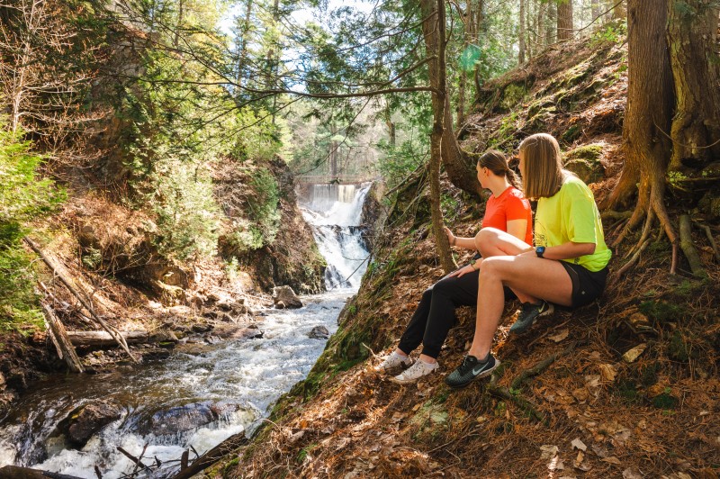
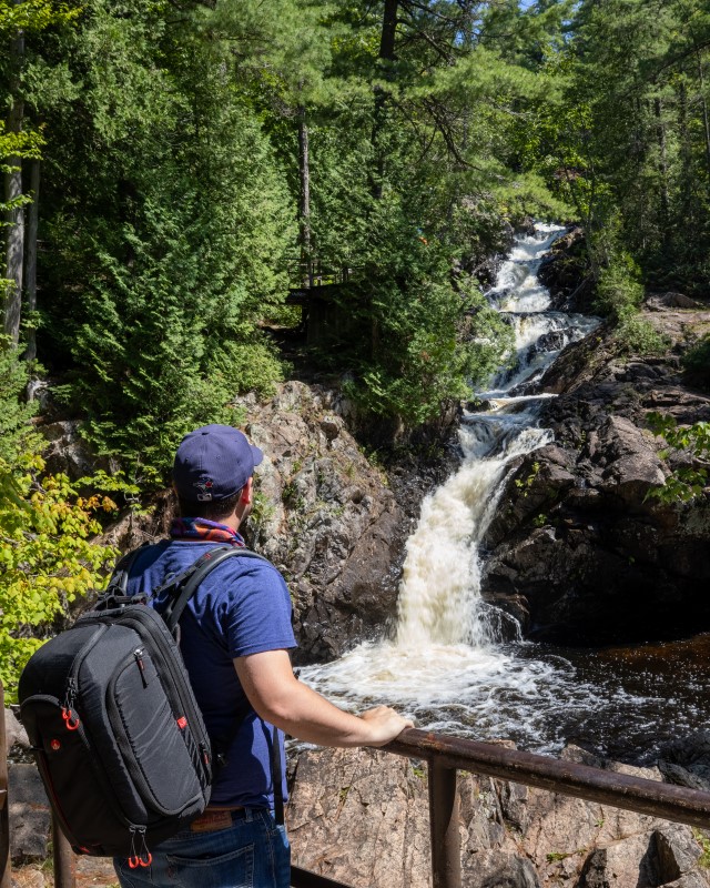
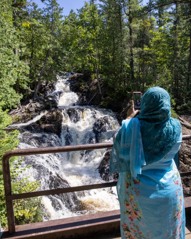
Crystal Creek Waterfalls: Part 1
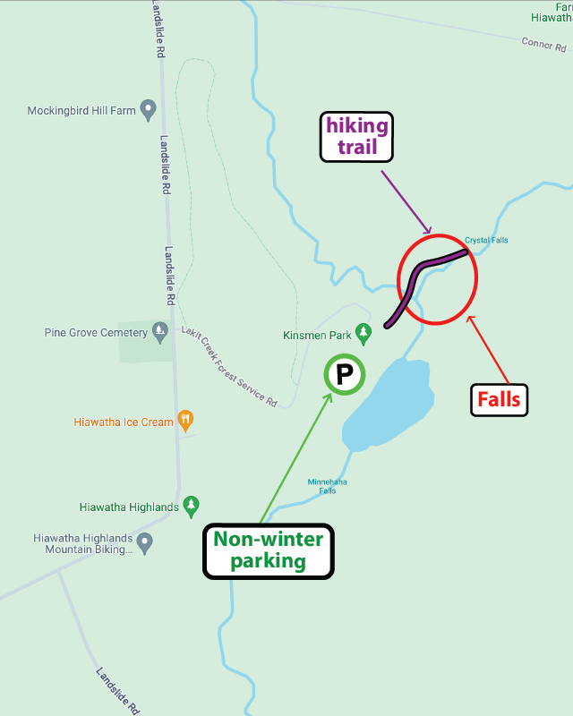
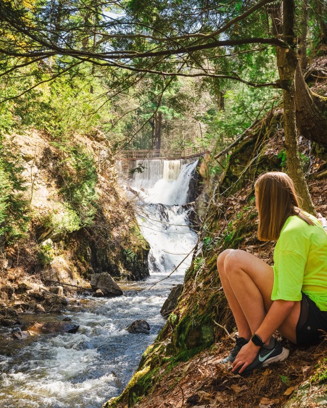
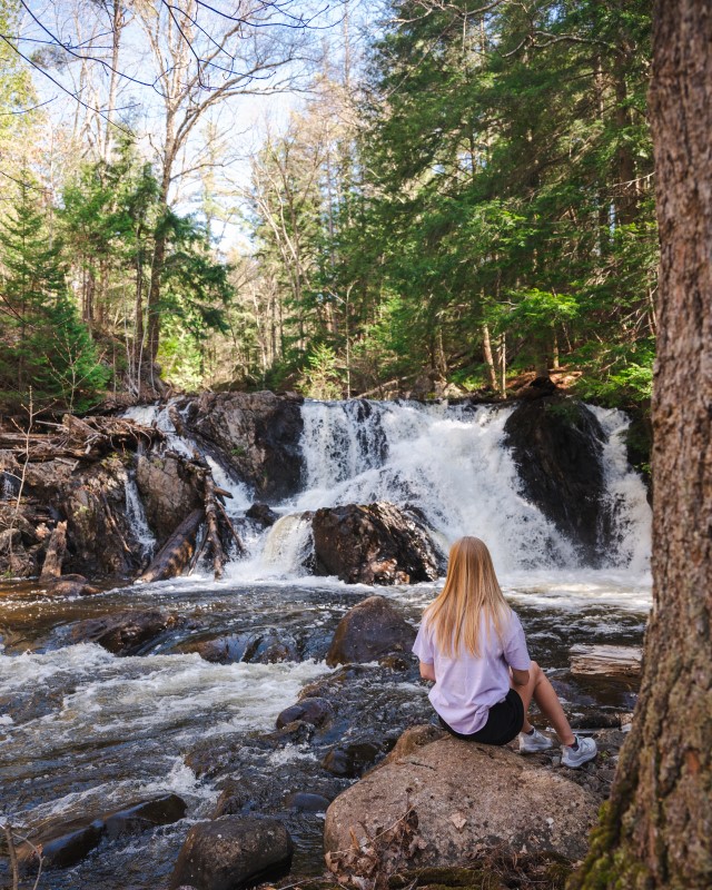
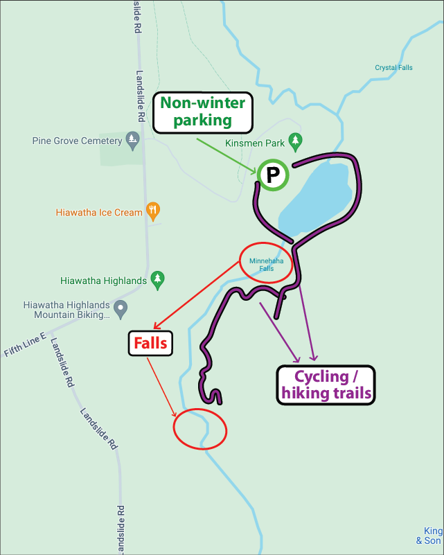
The beautiful Crystal Falls at Kinsmen Park, with a total height of around 20 metres, is one of the most popular visitor spots in Sault Ste. Marie, attracting thousands of visitors each year. Easily accessible from the Kinsmen Park parking lot at Hiawatha Highlands, a boardwalk with handrails leads to the base of the falls with steps leading up to several viewing platforms.
On the other side of Thayer Reservoir, in Kinsmen Park, are the lower Crystal Falls, including the delightfully named Minnehaha Falls. Access to these falls requires a little more work than the higher ones, with some hiking and exploring just off the multi-use cycling/hiking trail TLC, but the rewards are worth it!
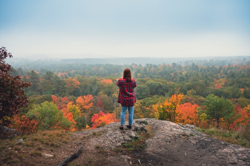
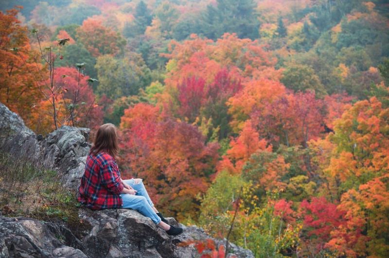
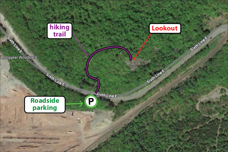
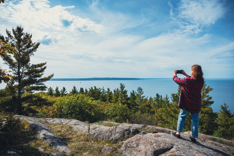
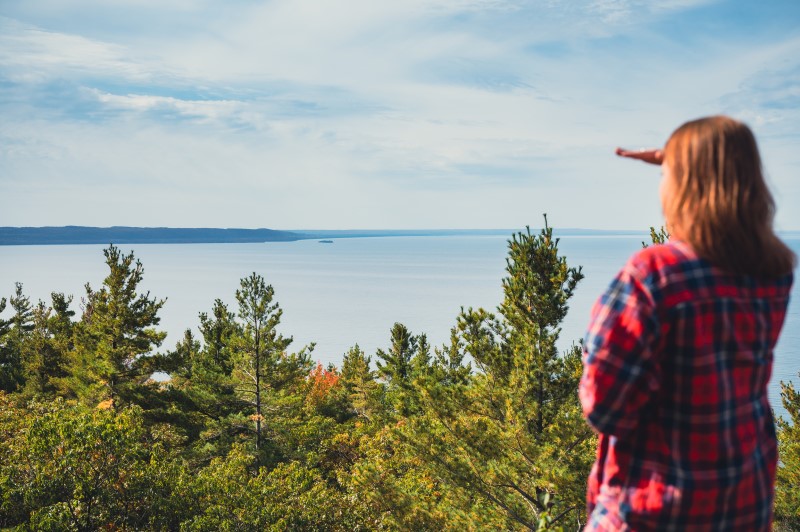
The Odena lookout and Odena Loop at Hiawatha Highlands is part of the Voyageur Trail. The large ‘Loop’ trail is a 4.2km hike that starts at Sixth Line and weaves itself over to Connor Road. Alternatively if you just want to enjoy the incredible view, the Lookout hike is a short 400 metre trot uphill. Once you get to the top the view will take your breath away. Beautiful maple fall colours blended with vibrant coniferous greens make this lookout truly spectacular.
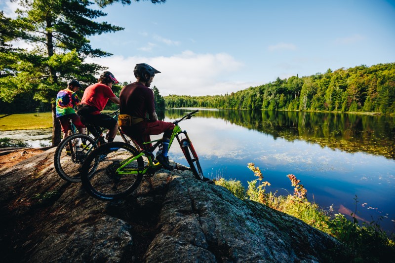
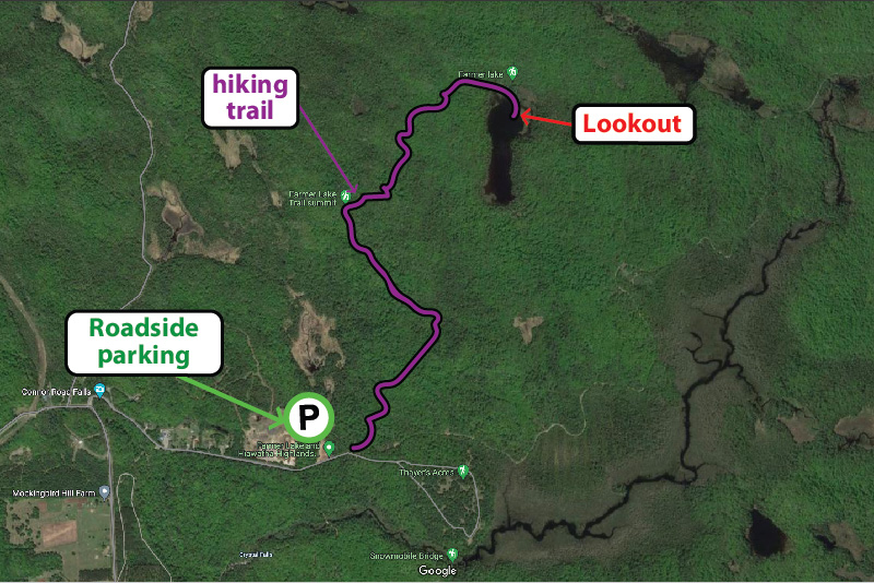
Checkout the Beaver Loop, an out and back 4km loop with a beautiful lookout at Farmer Lake – also part of the Voyageur Trail at Hiawatha Highlands. The trail head is at the end of Connor Road, where there is ample parking, then the trail heads north and east, initially along the route of the Odena Loop before forking off to the right. The trail is a multi-use trail so you’ll find hikers and cyclists alike!
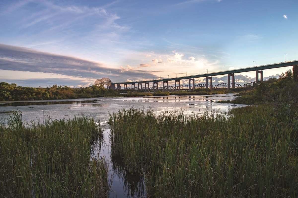
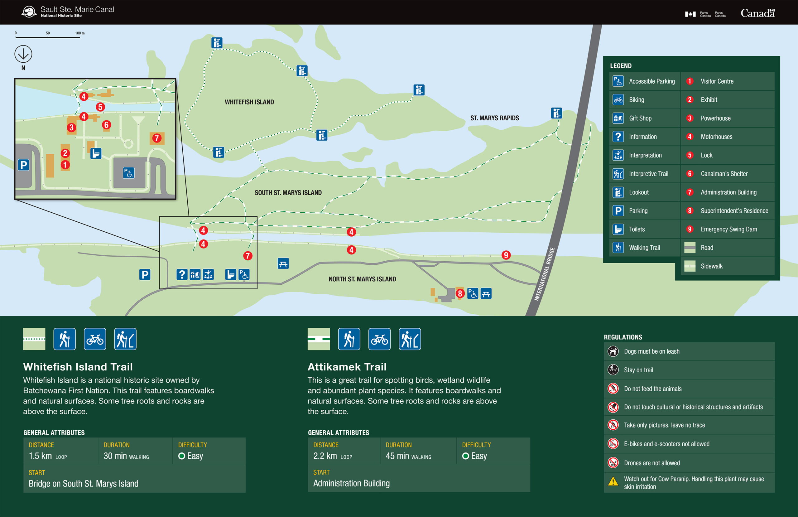
The Attikamek trail on Whitefish Island is a beautiful and easy-paced hike, perfect for enjoying nature. Parking is at the trailhead, located at Sault Ste. Marie Canal National Historic Site, from where you can access the Island across the famous locks. Batchewana First Nation Whitefish Island Reserve is a traditional territory and meeting ground of the Anishinaabe peoples of the Great Lakes due to the abundance of natural resources and fish in the St. Marys River
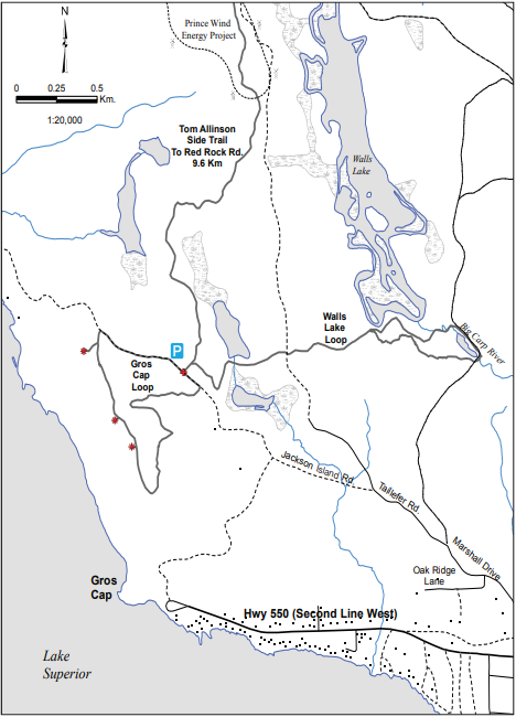
The lookout at Gros Cap Conversation area is another great spot just outside the city limits. While the tree species here don’t offer the vibrant red and oranges of Hiawatha, you can still enjoy fall tones with incredible views of the place where Lake Superior flows into the St. Marys river, the Gros Cap lighthouse, and any Lake Superior ‘lakers’ that happen to be cruising past.
The lookout is part of the Saulteaux-Goulais section of the Voyageur Trail, which leads west and north towards Red Rock.
Join us at the Canadian Bushplane Heritage Centre for a Thrilling Day of Snowbird-Themed Fun and Entertainment!
The world-famous Snowbirds, the Canadian Forces esteemed air demonstration team, are heading to Sault Ste. Marie, Ontario on Saturday, September 21st, and the Canadian Bushplane Heritage Centre is making a day of it!
Bushplane Days, the annual 2-day celebration, is hosting a pre and post-show featuring Snowbird-themed entertainment, plus there will be a designated waterfront viewing area, so you can get front row seats to one of the most anticipated shows in Sault Ste. Marie!
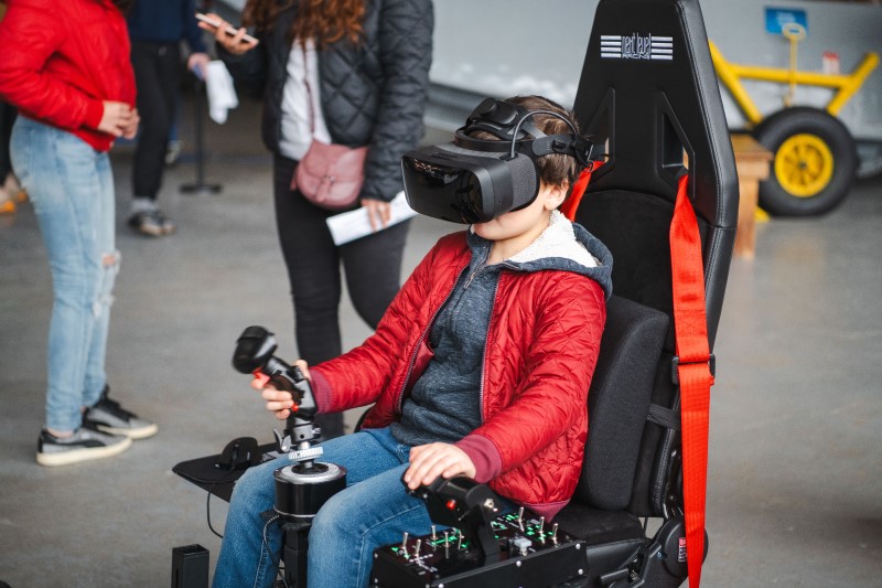
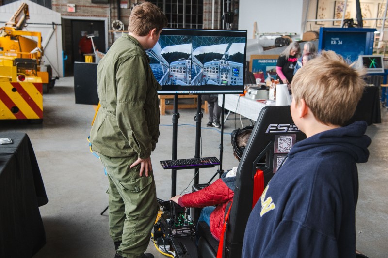
In addition, you can experience the thrill of flying in the Snowbirds yourself via a new virtual reality simulator provided by VSB Foundation, which will be situated in the Bushplane Museum all day Saturday and Sunday.
Finally, stick around after the show when the pilots will be back in town for an exclusive meet-and-greet at the Canadian Bushplane Heritage Centre from 4.30-6pm.
The Snowbirds
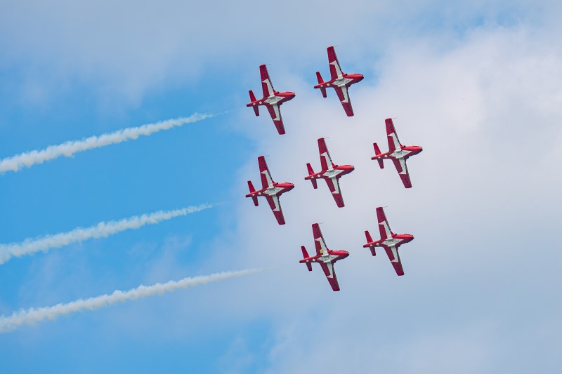
The Snowbirds are the Canadian Forces esteemed air demonstration team and have been operating since the 1970s. They typically fly in formations of 9 aircraft with manoeuvres designed each season and approved by the Canadian Forces. The Snowbirds fly the Canadair CT-114 Tutor, a Canadian-built jet that was used by the Canadian Forces until 2000. The Tutor weighs approximately 7,170 lbs (3,260 kg) and is powered by a J-85 engine producing 2,700 pounds of thrust. Top speeds of the aircraft during the displays range from 100 to 320 knots or 185 to 590 km/h, and the planes fly as close as 1.2 metres to each other!
The Show
The airshow is scheduled to begin at 2pm and will be visible along the Sault Ste. Marie waterfront. The show is designated as a non-aerobatic display. Feel the rumble and immerse yourself in the thrill as the Snowbirds soar and swoop just 500 feet overhead, delivering an unforgettable airshow above the St. Marys River. The show is anticipated to be approximately 30 minutes overhead and will be accompanied by music and live commentary.
Local Connection
The Snowbird Boss (Lead Pilot) is Major Brent Handy, a graduate of Sault College’s aviation program. Major Handy succeeded into the role in of Snowbird 1 for the 2024 season and attended Sault College from 1996 to 1999. In addition, a second pilot flying Snowbird 9 Captain Patrice Powis-Clement, grew up on nearby St. Joseph Island and also graduated from Sault College’s Aviation Technology Flight program.
Major Brent Handy
Captain Patrice Powis-Clement
Saturday, September 21st, 2024
Day 1 of Bushplane Days is dedicated to celebrating aviation history, including the 100th Anniversary of the Canadian Airforce with the Snowbirds airshow. Activities throughout the day will be Snowbird-themed. Doors open at 10am with a variety of family-friendly activities including facepainting, crafts and fun with Entomica creatures.
New this year is the addition of a digital technology company VSB Foundation, who will be offering the very latest virtual reality flight simulator experience. Find out what it feels like to fly with the Snowbirds with this new, fully immersive experience that leverages the latest cutting-edge technology. The VR simulator, will put you in the (virtual) seat of a Snowbird aircraft and will be available at no additional cost, on a first-come, first-served basis during the day.
At lunch time enjoy food from the BBQ, listen to live music and enjoy a specially brewed ‘Tipsy Beaver’ beer by Northern Superior.
Then, at 2pm, witness the specular aerial display of the world-famous Snowbirds in a designated, waterfront viewing area on the apron of the Bushplane Museum. Limited seating will be available.
The entertainment continues after the show with more live music, food and drink. At around 4.30pm, you can get a chance to meet the Snowbirds pilots as they head back to the city for an exclusive meet-and-greet at the Canadian Bushplane Heritage Centre.
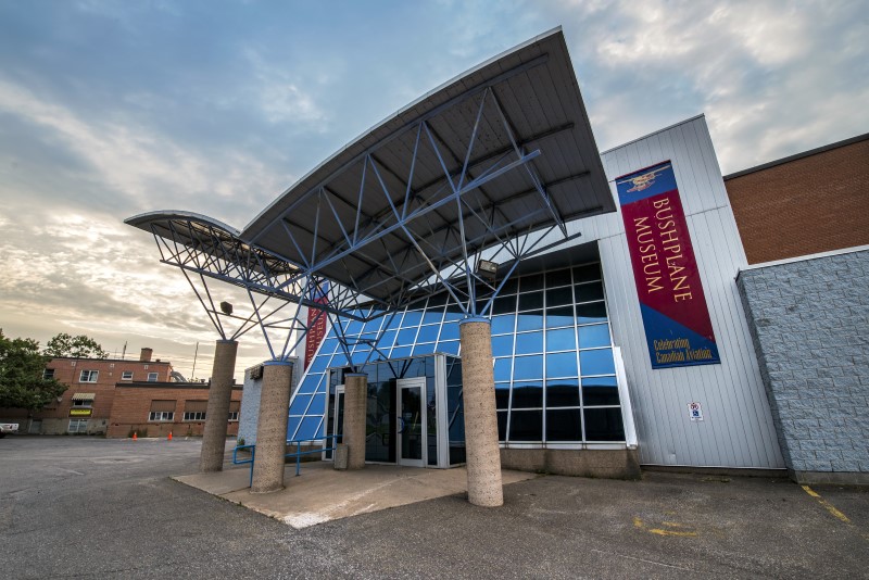
Canadian Bushplane Heritage Centre
VSB Foundation's VR simulator
The pilot's view
Bushplane Days Schedule
Check out the festival schedule below! Admission is by donation but a $10 donation will get you free ice cream or lemonade!
Saturday
10am-6pm
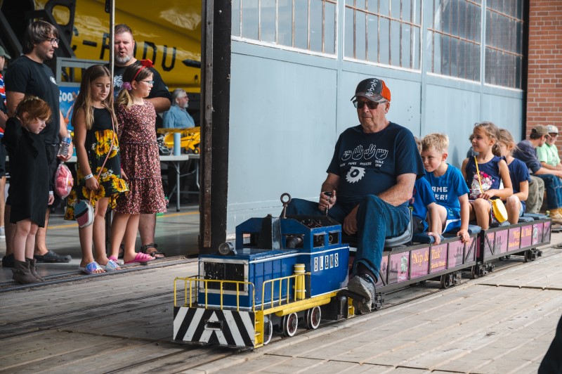
10am – Doors open, Bushplane Days begin! Crafts and games, axe throwing (for a fee), archery (for a fee), face painting, mini-train, mini-putt, large lawn games, Soo Radio Club, Brick Space, Snowbirds virtual reality simulator by VSB Foundation
11am – Fun and Funner
10-1pm – A Firetruck is on site for kids to explore and learn about
11.30am – 5.30m – BBQ & beverages
1pm- 5pm – Live Music: Brendan Hodgson & Mid Life Crisis
2pm – Snowbirds Aerial Display!
4.30pm to 6pm (approx.) – Meet and greet the Snowbird pilots!
Sunday
10am-4pm
10am – Doors open, Bushplane Days begin! Crafts and games, axe throwing (for a fee), archery (for a fee), face painting, mini-train, mini-putt, large lawn games, Soo Radio Club, Brick Space, Snowbirds virtual reality simulator by VSB Foundation
10-11am – Interactive Kids’ Storytelling with Bushplane Stories
11am – Fun and Funner
Noon – 12.30pm – MNR airshow display over the St. Marys River
11.30am (and every hour) – Interpretive Canoe Excursions Model Flight Airshow (for a fee)
11.30am – 3.30pm – BBQ & beverages
12.30pm – 4pm – Live Music: Julianna Reagan, Northern Jazz Ensemble
V.I.P. Meet & Greet With The Snowbirds
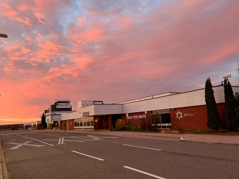
On Friday, September 20th, the day before the Snowbirds show over Sault Ste. Marie’s waterfront, there is a ticketed VIP meet and greet event happening at the Sault Ste. Marie airport.
An excursion from the Bushplane Museum to the airport will leave at 10.30am. Get all the information here plus tickets here.
Other Viewing Options
With the airshow spanning the waterfront the best viewing locations will be from the Sault Ste. Marie Canal National Historic Site all the way down to Bellevue Park.
Clergue Park will host the Snowbird’s very own commentator stage. This commentary of the aerial display is a key feature of the Snowbirds routine and will be broadcast on a local FM radio station (to be confirmed closer to the time) so viewers can hear the show from all locations.
The Roberta Bonda Pavilion will also be a great spot to view the Snowbirds and the Miss Marie is running a special Snowbirds tour that day.
The Miss Marie
For a truly unique experience, board the Miss Marie Lock Tour boat for a special Snowbird themed charter on the water, directly below the airshow. Departing at 1pm and returning at 3pm guests can enjoy a river cruise and airshow for $60 per person. Limited tickets available. Appetizers will be served and the charter is fully licensed.
Come down to the Bushplane Museum on Sunday where the fun continues. This year is the 100th anniversary of OPAS (Ontario Provincial Air Service) and there will be celebrations to honor this achievement. More details and exciting announcements to come!
Thanks to the Sault Ste. Marie Airport, for hosting the Snowbirds, as well as providing logistical and technical support. “As the private owner and operator of the Sault Ste. Marie Airport, we see this as a gesture of support for our community and an opportunity to spark interest in aviation across all age groups. This event aligns perfectly with milestones in aviation history, making it especially meaningful for us.” Terry Bos, President and CEO of the Sault Ste. Marie Airport Development Corporation.
Take a Daytrip to some of the most beautiful and relaxing sandy beaches in Ontario
Sault Ste. Marie has some of the best sandy beaches in Ontario. Our beaches are incredible! All around our city you’ll find perfectly beautiful, long sandy beaches with crystal clear water that are perfect for a swim, a play in the sand or just to relax and soak up the sun. Great beaches are just one reason Sault Ste. Marie is the perfect place for a summer vacation.
Check out this list of 6 of the best sandy beaches in Ontario, all just a short drive from Sault Ste. Marie. And check out our Summer in the Soo video too!
No.1 – Pancake Bay Provincial Park and beach
A leisurely 45 minute drive north on the Trans-Canada Highway along the stunning Lake Superior coast is Pancake Bay Provincial Park Beach – one of the best sandy beaches in Ontario.
This beautiful area is known for its more than 3 km of golden sand beach and crystal clear, Caribbean blue water. The Edmund Fitzgerald Lookout hiking trail gives an incredible panoramic view of the lake if you are looking for some exercise before relaxing on the sand.
The Park is one of the area’s most popular camping destinations with excellent and comprehensive facilities.
Just south of Pancake Bay lies lies Batchawana Bay Provincial Park, another great Ontario beach on Lake Superior. Batchewana Bay’s sun-soaked, 5 km beach is the perfect place to spend a summer’s day with the family. The water here is shallow, warm and perfect for swimming! Facilities include picnic tables and bathrooms.
Passes for this day-use provincial park can be made online or at the visitor center located on Highway 17.
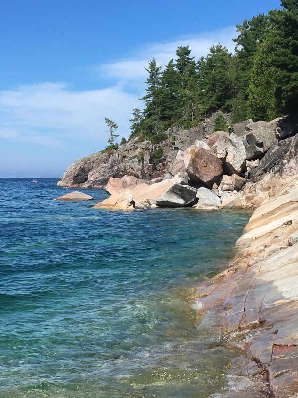
At the southern end of Lake Superior Provincial Park lies Agawa Bay Beach, a stunning 3km long sandy beach. The water at Agawa Bay can be a little chillier than the more sheltered beaches further south, even at the height of the summer, but this doesn’t impact the natural beauty of shore where stunning hills and cliffs of the Canadian Shield frame the beach on either end.
There are plenty of options for recreational water activities be it paddling, body surfing or swimming. There is also a fantastic visitor centre, featuring stories from Lake Superior and information on local wildlife. Just to north of the Bay is the Agawa Rock Pictographs, one of the most famous Indigenous pictograph sites in Canada.
Agawa Bay is part of Lake Superior Provincial Park, which is one of the largest provincial parks in Ontario. The park boundaries extend north all the way to Wawa, bisected by the Trans Canada Highway. Agawa Bay also has a fully equipped campsite, in case you want to extend your stay. If a daytrip suits you better, then a beautiful 90 minute trip up the Superior coast is a great way to beat the crowds and explore the beauty of Northern Ontario.
Harmony Beach in Haviland Bay is the first beach you will encounter when travelling north on the Trans Canada Highway along the Superior coast from Sault Ste. Marie. This public beach is a local’s favourite, only a half-hour drive from Sault Ste. Marie and featuring 3.2 km of stunning sand and great swimming.
It’s also close to the Haviland Bay Voyageur Trail with stunning views that look out over the lake. So after your hike, take a swim!
Pointe des Chênesis a family-friendly sandy beach in Sault Ste. Marie city limits. This slice of paradise is only a short drive from downtown. It’s the perfect spot for building sandcastles and swimming. Located on Lake Superior at the mouth of the St. Marys River, this great Ontario beach is also an awesome spot to watch the big Great Lakes ships go by.
Peaceful St. Joseph island lies just to the east of Sault Ste. Marie on Lake Huron’s North Channel, off of the Trans Canada Highway. It’s a must-see for visitors, featuring many great Ontario sand beaches. The communities of Hilton Beach and Richards Landing have marinas for boaters, as well as restaurants and shops making it a perfect day trip. Best of all, the island’s wonderful beaches are uncrowded and pristine.
Hilton Beach is home to Forbes Beach and Community Park. This sandy beach features numerous picnic tables, a buoyed swimming area and a raft that swimmers can jump off. Public washrooms, change rooms and playground equipment make this a pleasant destination for an afternoon getaway. The Hilton Beach boardwalk connects the beach to the picturesque marina.
The community of Richards Landing is located on the west side of St. Joseph Island. Women’s Institute Park has a sandy public beach, safe swimming, playground equipment, picnic pavilions and a tennis court. The area is also home to amazing mountain biking and road cycling. Rentals are available at the Richards Landing Marina for those wishing to explore the numerous groomed trails and natural beauty of the island’s forests.
From Powwows to Art and Places of Learning, Sault Ste. Marie is a city rich with Indigenous culture
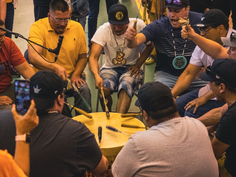
Sault Ste. Marie is the perfect place to spend some time together as a family. Also referred to as Bawating, meaning “place of the rapids”, the area is rich in Indigenous culture and history. From the whir of excitement at a local powwow to the somber history of the residential school system, there is so much for you to learn and experience together in Sault Ste. Marie.
Here are 7 ways you can experience Indigenous culture in the Soo:
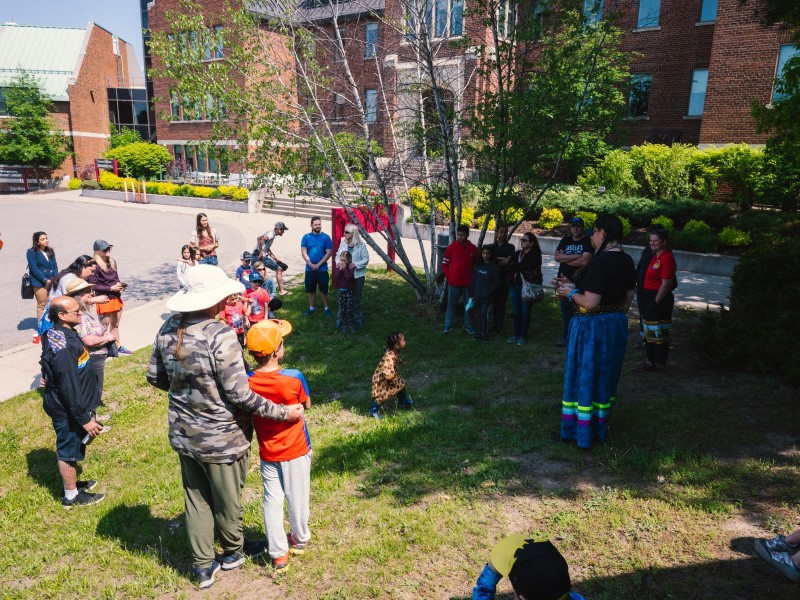
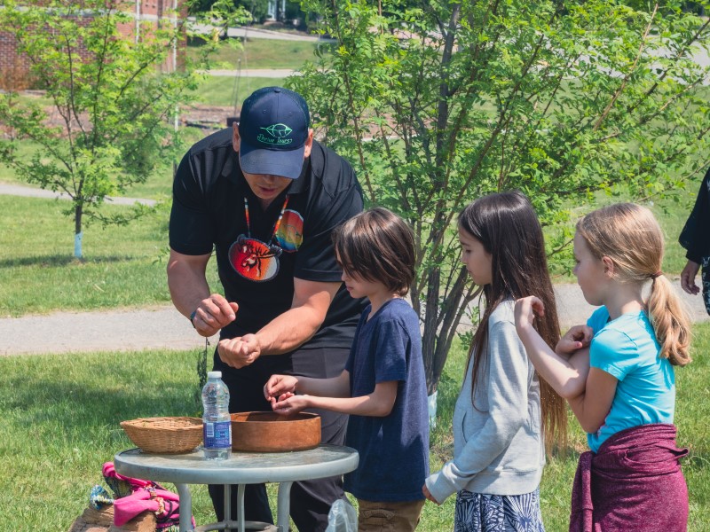
Go on a Learn to Powwow Tour
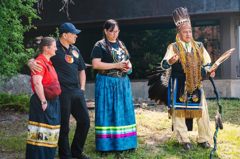
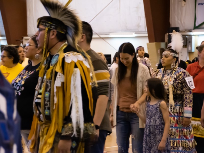
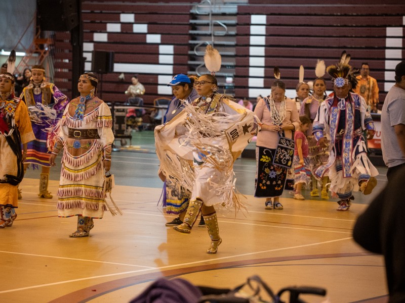
Whether you’ve been to a powwow before or want to experience one for the first time, you will love the Learn to Powwow Tour with Thrive Tours. Your tour guides will start you off with an introduction, covering powwow history and etiquette, and explain how you can engage in the celebration as a non-Indigenous person. You will also learn the significance of the music and about the different kinds of dances. After your powwow intro, you will join your guides for the spectacular Grand Entry where you’ll watch the dancers enter the circle in their regalia and listen as the drummers echo the heartbeat of Mother Earth. To complete your experience, make sure to try some food, explore the vendors and maybe even join in during an intertribal dance!
The Powwow Tour
Brad from Thrive Tours explaining Powwow customs
All are welcome at intertribal dances
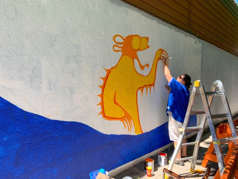
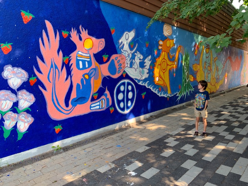
See the Indigenous Art Murals
As you make your way through the buildings and streets of Sault Ste. Marie, you will notice the many large murals painted throughout the city. Many of the murals you’ll find here have been painted by local Indigenous artists. This display of artwork adds a splash of color and vibrancy to the city that everyone in the family will enjoy! Each June, during the Summer Moon Festival, you can watch new murals being painted around the Soo and experience many other Indigenous arts & culture workshops, exhibits and performances.
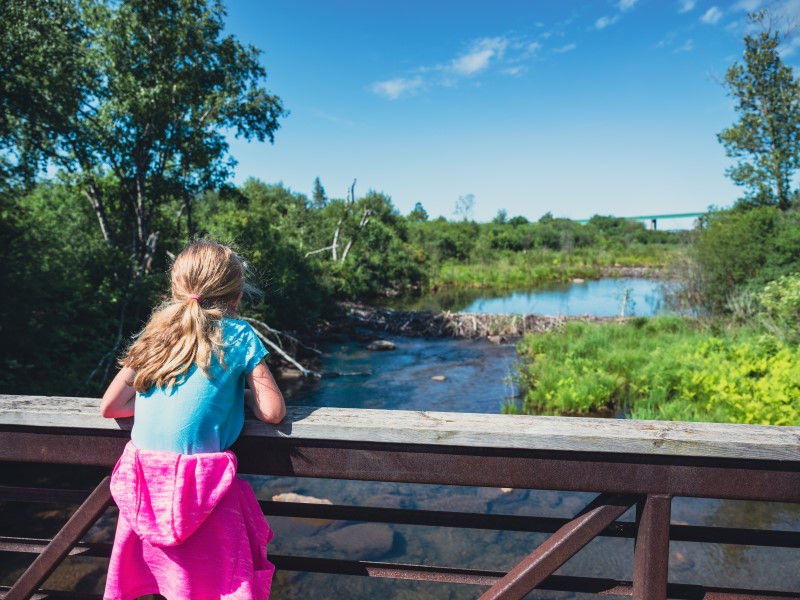
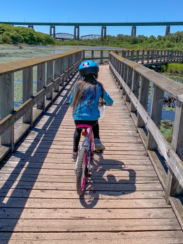
Explore Whitefish Island
Grab your bikes or walking shoes and spend some time exploring the Indigenous history of Whitefish Island. Whitefish Island is a territory of the Batchewana First Nation and a National Historic Site of Canada. Plaques located around the island provide information about the history and significance of the area, dating back hundreds of years. Once home to many, Whitefish Island was a significant site for fishing and trading throughout history. Now, the island is a popular birding location and the well-maintained trails and boardwalks allow visitors to easily access and enjoy nature.
Paddle on the St Marys River
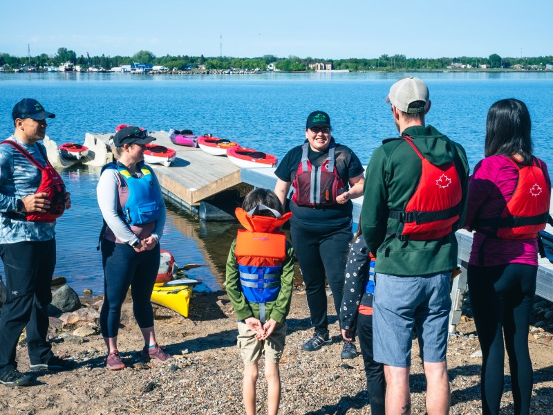
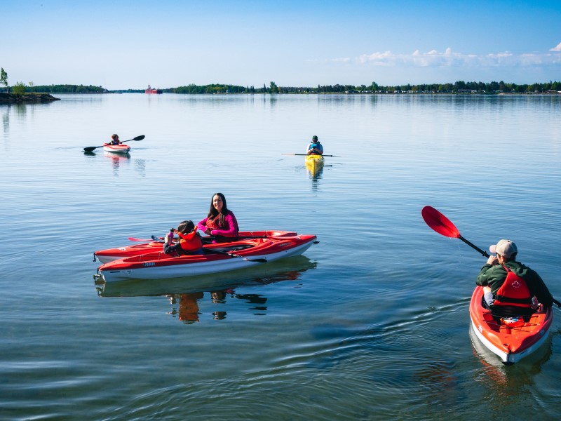
Get out on the river in a kayak or canoe with Thrive Tours. Your adventure begins with acknowledging the history of the land and showing respect to the water by saying “Miigwetch”, which means “thank you”. Next, you will receive instruction on paddling and water safety before getting in your boat and setting off on the river. Boats, paddles and life jackets are available for both adults and children. While on the water, you will learn about the history of the area and you may even be treated to a traditional song sung by your tour guide.
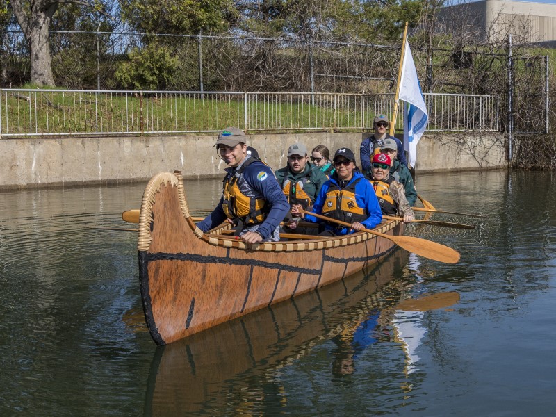
Canoes for Conservation also offer interpretive tours of the St Marys river in their popular ‘big canoe’. Dip your paddle into the famous Whitefish Rapids at Bawating, one of the most significant cultural gathering places of the Anishinaabe People since time immemorial. These tours are popular with groups and families and expert guides provide a rich description of the area.
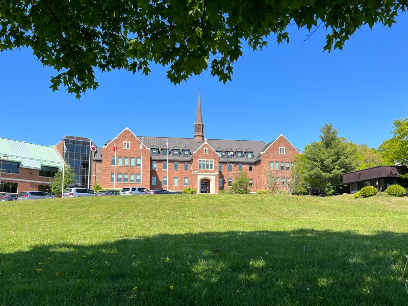
Take a Residential School Tour
The Shingwauk Residential School in Sault Ste. Marie was operational from 1875 until 1970. Join Thrive Tours to see the residential school grounds and buildings, now part of the Algoma University campus, and learn about the residential school system. You will hear about the devastation the system had on the Indigenous people in the not-so-distant past and the inter-generational trauma affecting communities and families today. If you are touring with kids, information is shared in a truthful yet age-appropriate way. Learn about what is being done for healing and restoration and what you can do in this process as an ally.
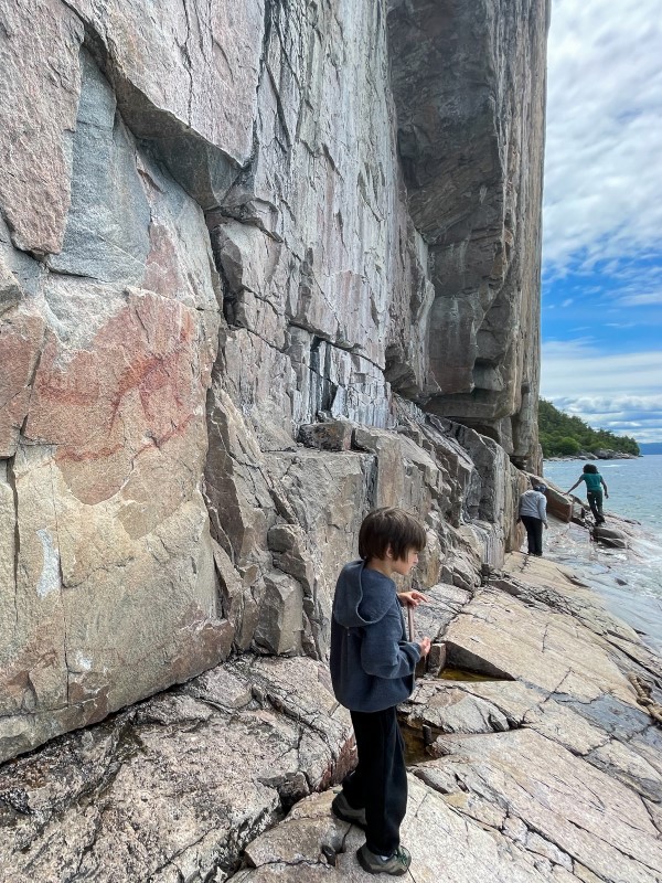
Hike to See the Agawa Rock Pictographs
Take a beautiful drive along the Trans Canada Highway to see the Agawa Rock Pictographs in Lake Superior Provincial Park. Located about 1 hour North of Sault Ste. Marie, this 0.5km loop trail will take you right along the shore of Lake Superior to the Indigenous archaeological site where you can see sacred Ojibwe paintings dating back to the 17th and 18th centuries. The hike is rated as moderate, but some scrambling over rocks is required. To see the pictographs, you’ll need to walk out on a sloped rock shelf beside the lake. The views are definitely worth it, but please take caution as the rocks can be slippery!
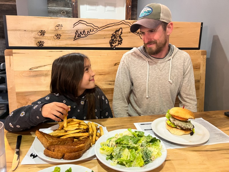
Enjoy a Meal at Chummy’s Grill
After working up an appetite during your Sault Ste. Marie adventures, stop by Chummy’s Grill for a delicious meal. This local Indigenous-owned and operated family restaurant has a wide variety of delicious food available. The restaurant has a great kids menu and even has all-day breakfast (except Friday 4-8pm). While here, make sure you spend some time admiring the wood carvings located throughout the restaurant.
Now it’s time to get your family and come explore Bawating! With so many different ways to experience Indigenous culture in the Soo, you’ll want to keep coming back for more.
And read our blog post from summer 2021 about spending a day with the family in Sault Ste. Marie here!
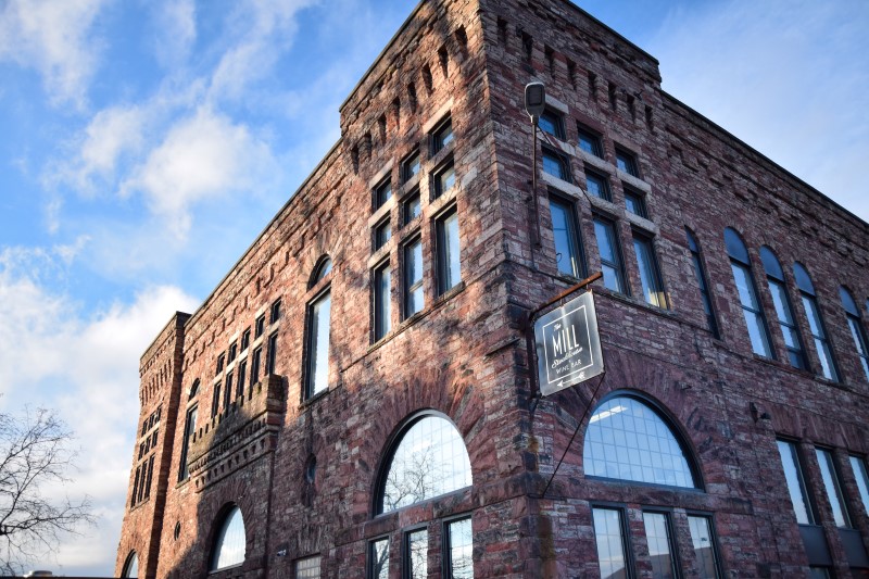
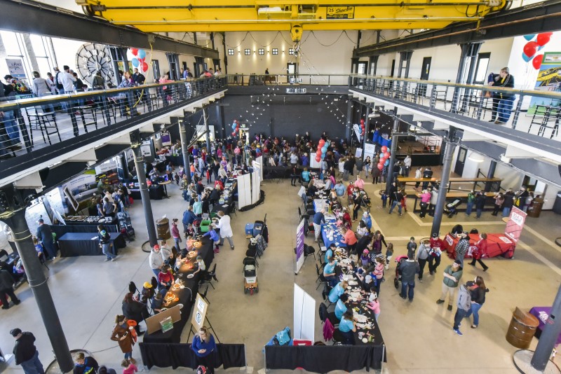
Sault Ste. Marie's Canal District is a newly restored part of the city that includes Restaurants, event spaces, the Train Station and more
Once a key industrial part of Sault Ste. Marie, the Canal District has been reimagined, restored and rebuilt to be one of Northern Ontario’s premier destinations for dining, entertainment and tourist attractions.
A new train station for the Agawa Canyon Tour Train, built in a style that compliments the historic surrounding buildings, is just one of exciting developments to have happened that has revitalized a key area of the city. There is also a microbrewery, four restaurants, a gelato mill, an outdoor adventure store complete with indoor climbing wall, an exhibit centre-gallery, an outdoor event centre and a rink!
Keep reading to find out more about this exciting destination in the city.
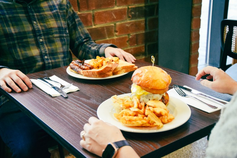
The Machine Shop's Restaurants
The Machine Shop boasts three magnificent restaurants as well as a top notch win bar.
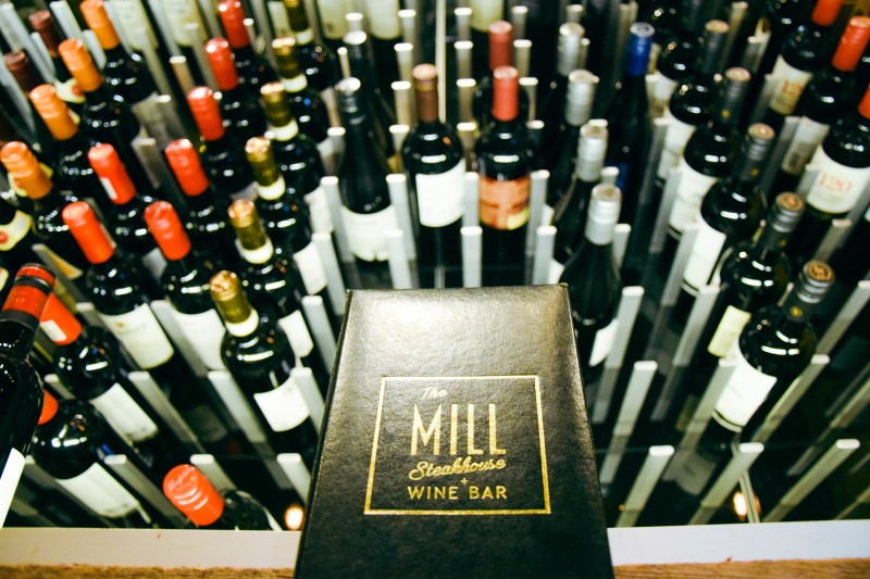
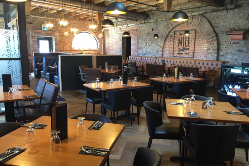
The Mill Steakhouse + Wine Bar is fine dining at its best; 45 day aged AAA Ribeyes, 16oz New York Striploin, Prime Rib and all with fresh ingredients, in an elegant setting with superb service and friendly atmosphere.
The Boiler Room is an easy, family-friendly pizzeria, offering freshly prepared wood-oven pizza in a relaxed steampunk style restaurant. Next door to the Boiler Room is a The Steamfitters Lounge; a unique space where you can enjoy the wood-fired pizza menu that is also available for private functions of up to 60 guests.
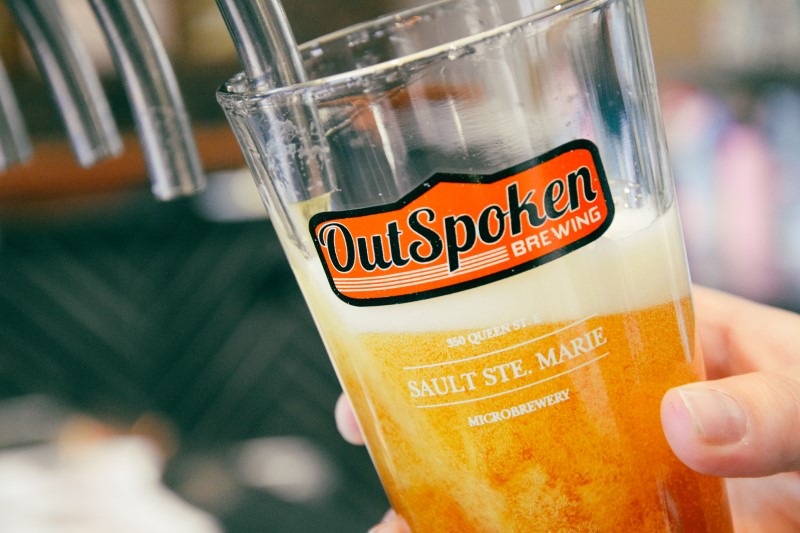
The Blockhouse Pub
The Blockhouse Pub offers great pub-grub, large portions and a full array of beer including locally brewed Outspoken, which is brewed on site. Stop for all day breakfast or come in for a grab and go panini from their delicious deli!
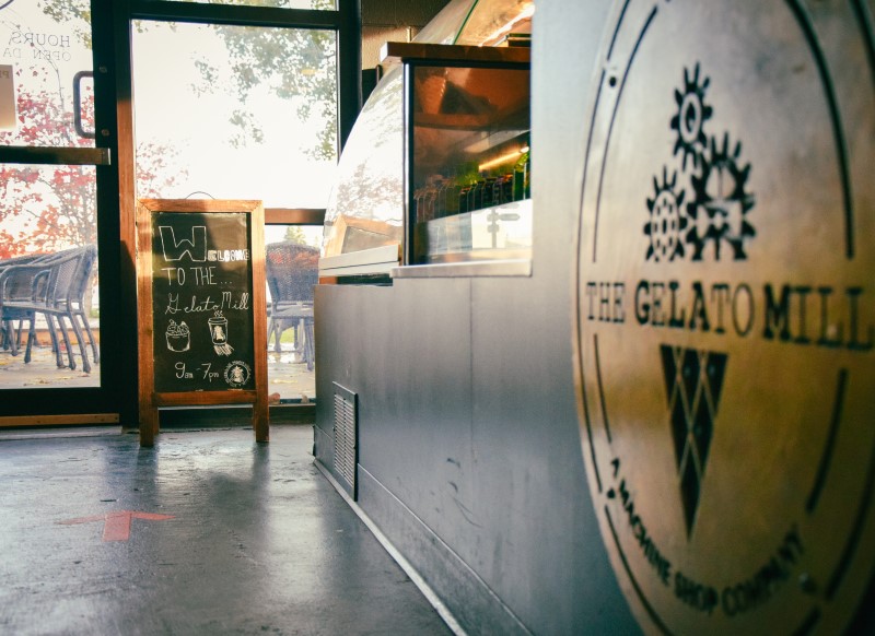
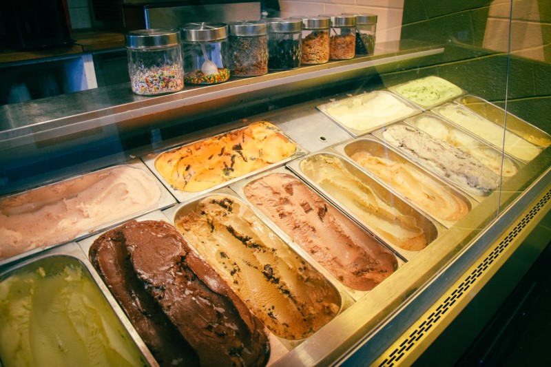
The Gelato Mill and Starbucks Coffee
The Gelato Mill offers fresh Starbucks coffee, lots of snack options including freshly made pastries and of course a variety of gelatos.
Create your own ice cream sandwich, indulge in a slushy, or stop by for a delicious treat and fresh cup of joe.
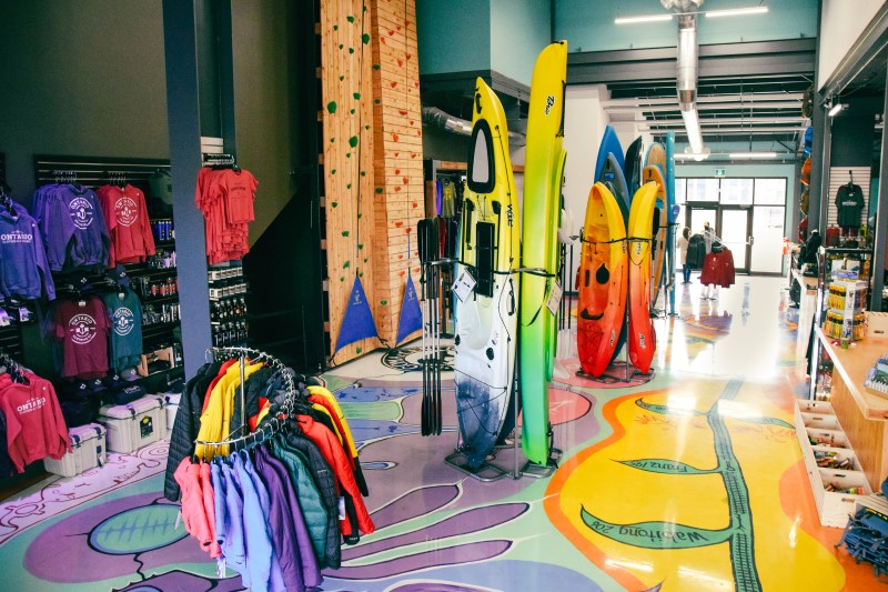
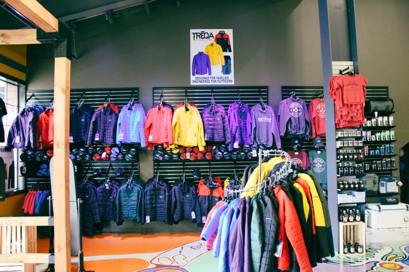
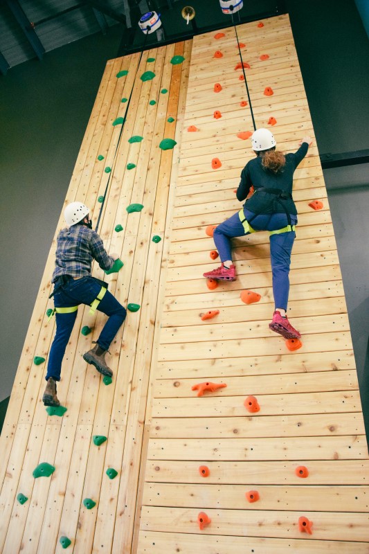
The Outfitters
The Outfitters is located inside the new train station building. It offers a wide variety of outdoor equipment and top brand clothing and accessories for your entire family – gear and clothing for adults & kids! You can climb our indoor rock wall or shop for a canoe, kayak or paddle board. Enjoy the amazing art by Indigenous artists Tomas Sinclair and John Laford.
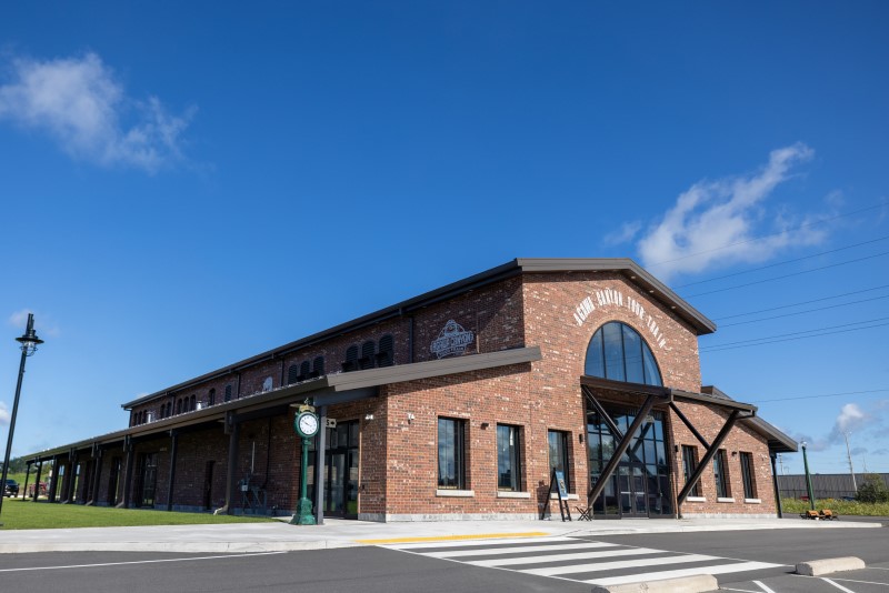
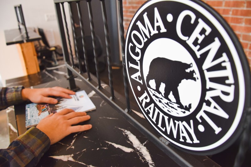
The Train Station
A prominent feature of the Canal District is the newly build train station for the Agawa Canyon Tour Train. The station is open and tickets can be purchased while the train is running during the summer and fall months.
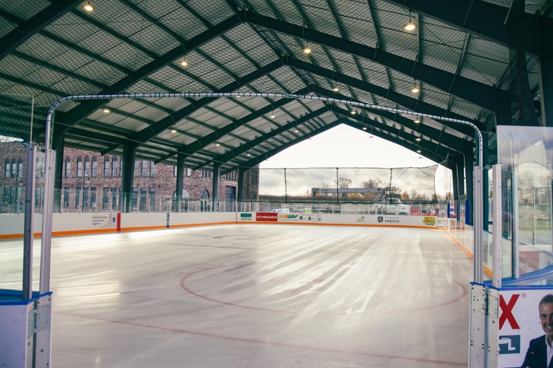
The Rink
The Rink is a covered outdoor skating rink that is available for hire or for public skates during the winter months. During the summer the rink turns into an events space (see below for more info on that). Check out the Rink’s website here for all the information you’ll need on using the ice!
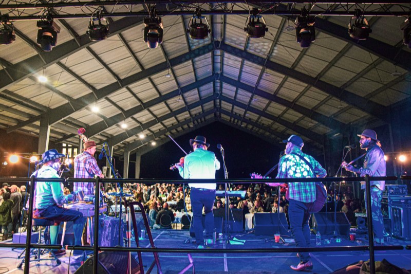
Lots of great events
The Canal District hosts events throughout the year from live music and comedy through to beerfest events, Christmas events and summer outdoor car shows and outdoor roadshows. Check out out the latest events here!
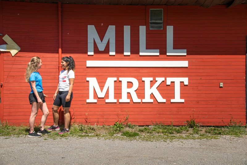
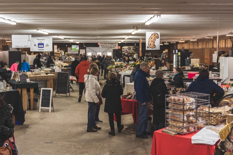
The Mill Market Farmers Market
The Mill Market Farmers Market is conveniently located just steps away from Canal District and Machine Shop. Grown, raised or crafted by Northern Ontario’s farmers, ranchers, fishermen, artists and artisans; Mill Market brings the best of our lakes, fields and forests to the heart of the historic Canal District in downtown Sault Ste. Marie. From farm to table,
The Mill Market is open Saturdays year-round 9am – 2pm, and Wednesdays 11:30am – 2pm (June 29th through September 7th, 2022). Visit this website for more information!
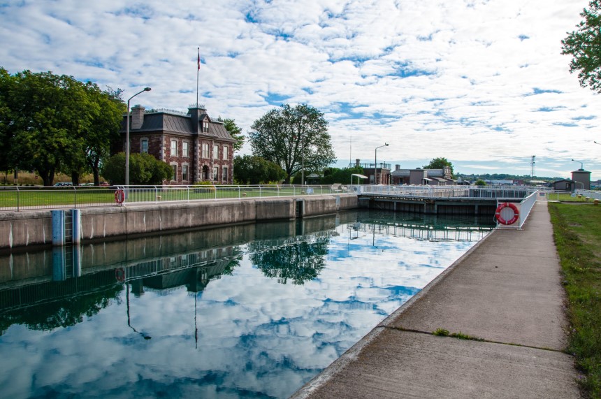
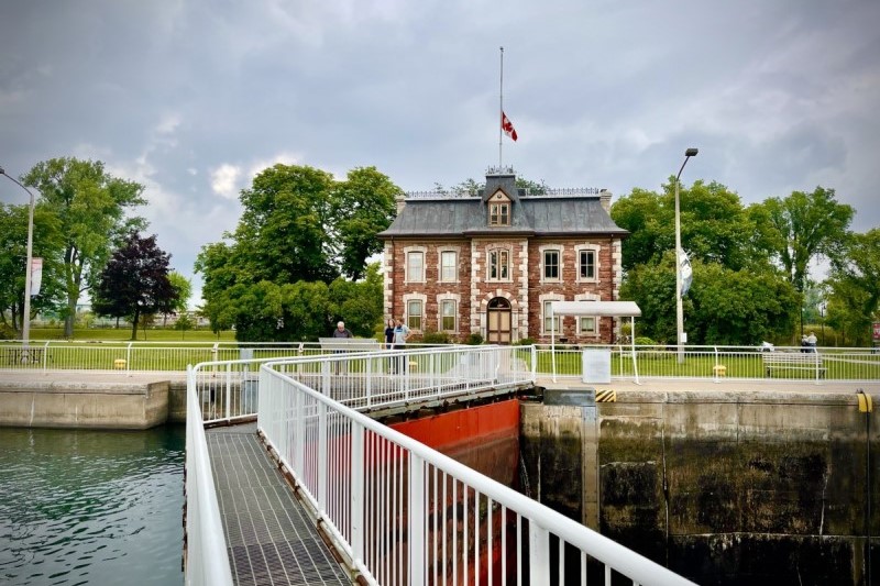
The Canal, built in 1895, was the world’s longest lock, the first to operate using electricity and the last link in an all-Canadian navigational chain from the Atlantic Ocean to Lake Superior. Today, the Canal is a great spot for boat-watching, picnics and a variety of other activities. Let a Parks Canada interpreter introduce you to the canal’s fascinating history, rent a Fat Bike, check out the new visitor centre.
For more information on the Canal District visit this website!