check out some of the best hiking trails in ontario
Sault Ste. Marie is the perfect place to visit if you want to enjoy some of the best hiking trail in Ontario. Incredible lookouts, magnificent waterfalls, the rugged Canadian Shield, important historical sites, and clean fresh air with just the sound of the wind in trees or waves on the shoreline… Here are eleven hikes in and around Sault Ste. Marie for you to enjoy.
Hikes within Sault ste. Marie
If you are looking to stay within the city limits then check out these three great trails, perfect for a family hike or if you are looking for a less strenuous trail.
1. The Hub Trail and Fort Creek
Length: 2km – 22.5km
Difficulty: Easy
Must See: Bridges over Fort Creek Conservation Area
If you are looking for a family-friendly hike in Sault Ste. Marie, then the Hub Trail is perfect for you. The trail as a whole is 22.5km of paved path and wooden boardwalk that circles the city.
You can of course choose the section you want to hike and the Fort Creek section is a popular choice for many. The trail takes hikers over three picturesque bridges, where there are lots of opportunity to enjoy the beautiful scenery of the creek below as well as many opportunities to spot all the interesting creatures that live there. Keep an eye out for hawks, great blue herons, and monarch butterflies.
Visit this Hub Trail page for more information including a link to a complete map!
Whitefish Island is a National Historic Site for Canada. It’s also a traditional territory and meeting ground of the Anishinaabe peoples of the Great Lakes due to the abundance of natural resources and fish in the St. Mary’s River.
This site is complete with an easy to follow trail system marked with informational plaques explaining the importance and historical relevance of the island. These trails will lead you through nature preserves right to the historic fishery of the St. Marys River Rapids.
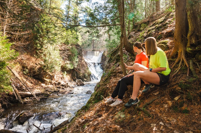
The Voyageur Trail is a public hiking trail consisting of almost 600km of wilderness style trails in Northern Ontario. The Hiawatha Loop (which goes past the stunning Crystal Falls), Odena Loop, Beaver Loop and Mabel Lake Loop make up around 20km of trails in this area.
This there-and-back trail through the beautiful maple forests of the Algoma Highlands takes you to one of best lookout hikes in Ontario. The trail begins at Robertson Cliffs Road and takes you to three incredible south and west facing lookouts. From there you can continue along and do the Robertson Cliffs Loop, passing a beautiful waterfall loop hike, or head back the way you came.
The trails are owned and cared for by Algoma Highlands Conservancy, a not for profit organization that is run by local volunteers. To access maps of the trail system click here.
A 30 minute drive north of Sault Ste. Marie takes you to Harmony Beach, where you hike to a spectacular lookout, Eagle Ridge Lookout, overlooking Lake Superior.
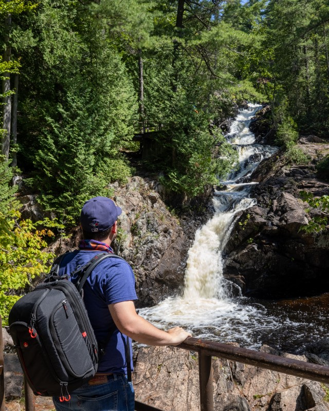
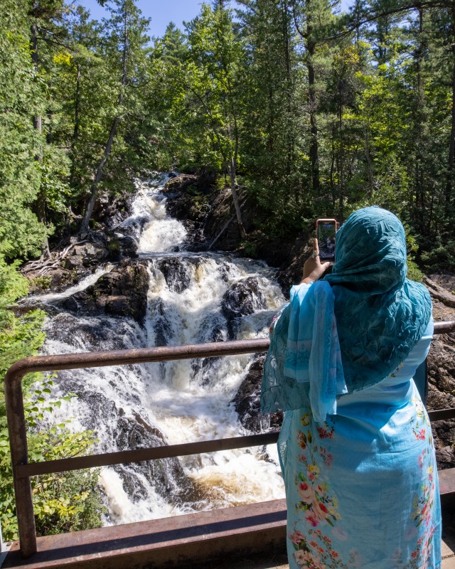
Chippewa Falls is a 35-minutes drive north of Sault Ste. Marie, parking and trailhead is right along the Trans Canada Hwy. The falls, which are visible from the highway itself, stand 25 feet high.
The hiking trail offers an easy 2.5km hike to the upper falls, which starts in the parking area and follows the river upstream to the top of the main falls. The path continues alongside the river past the upper falls if you want to explore further.
Chippewa Falls are a stop on the Group of Seven driving tour – the falls and rapids rapids inspired A.Y Jackson’s sketch ‘Stream Bed’. Lookout for a ‘Moments of Algoma’ art easel at the trailhead with more information about the falls and the famous group of artists!
Must See: The unusual smooth rocks overlooking the lake
An beautifully scenic drive east of the city through the Sylvan Valley, and just north of Bruce Mines, takes you to the Rock Lake trailhead. The Rock Lake trail is a offshoot from the Voyageur Trail system, and end up at a unique, smooth rock-top that feels like it should be inspiration for a Group of Seven painting.
Theses smooth rocks face north and lookout over Rock Lake, with an array of maple forests beautifully surrounding it.
The Edmund Fitzgerald lookout trail is another trail with a spectacular lookout. This one overlooks Pancake Bay Provincial Park (in which the trail is situated), Lake Superior and even as far as place where the Edmund Fitzgerald ship tragically sunk in 1975.
The trail system has 3 hikes available; 6km, 10.5km and 13.5km, with the latter hikes taking you to waterfalls and the inland Tower Lakes. For further information click here.
Hikes To The Lake Superior Coast
If you are looking further afield and want to take in all that the Lake Superior coast has to offer, then consider these beautiful hikes.
9. Agawa Rock Pictographs
Length: 1km
Difficulty: Difficult (slippery, steep steps)
Must See: The Sacred Pictographs
At the south end of Lake Superior Provincial Park are the Agawa Rock Pictographs. A clearly marked sign on Highway 17 directs visitors to a parking area at the trail head – map coordinates here.
The Agawa Rock Pictographs is one of the most famous pictograph sites in Canada and is one of the most visited indigenous archaeological sites too. It is a sacred site where generations of Ojibwe have come to record dreams, visions and events. Please respect and preserve the pictographs by not touching the paintings.
For those seeking true adventure, consider this spectacular and rugged coastal trail. It extends from Agawa Bay in the south to Chalfant Cove just north of Warp Bay in the north and will give you a true experience of Lake Superior. Local experts recommend taking 5-6 days because many sections require climbing over rocky headlands and cobble beaches, which can be technically challenging and require a steady pace for safety.
There are various spots for beach camping along the trail; you’ll enjoy incredible coastal scenery during the day and perfectly dark starry skies from your beached-down tent at night.
The Nokomis trail is a 3.8km round-trip lookout hike to overlook Old Woman Bay, in Lake Superior Provincial Park.
The trailhead is across the road from Old Woman Bay Beach parking, and the trail itself takes around 2 hours, with breaks to enjoy the incredible views!
Sault Ste. Marie and the Algoma District have countless hiking trails. Others include Gros Cap, Wishart Park and Odena Lookout, all within the Sault Ste. Marie city limits. The Ojibway Park Nature Trail in Garden River, just to the east of Sault Ste. Marie, is a beautiful ~4km trail that includes a boardwalk out to a lookout area. King Mountain is a great hike and can be reached by continuing your route past Robertson Cliffs. The Orphan Lake trail, in Lake Superior Provincial Park is popular in the summer and fall.
Do you have any other hikes in the area that you particularly enjoy? Tag us in your social media photos #outsideofexpected or our account handles @sault.ste.marie for Instagram and @saulttourism for Facebook. Happy hiking!
By Sault Tourism
adventures just steps away from your hotel or downtown
Sault Ste Marie has a number of well known hiking, lookout and fall-colour viewing areas just outside the city including Robertson Cliffs, King Mountain or Lake Superior. But you actually don’t have to travel as far to see some pretty spectacular sights! You can stay within the city limits and still get lookout views, see incredible waterfalls or enjoy beautiful, glassy in-land lakes.
So keep reading to learn about these mini-urban adventures in Sault Ste. Marie
Crystal Creek Waterfalls: Part 1
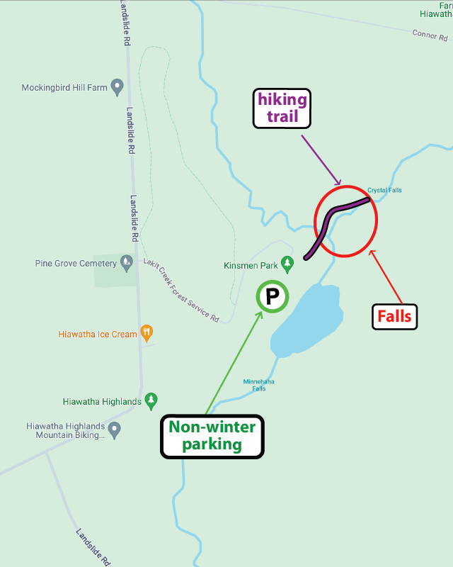
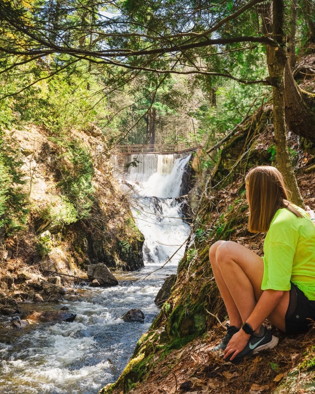
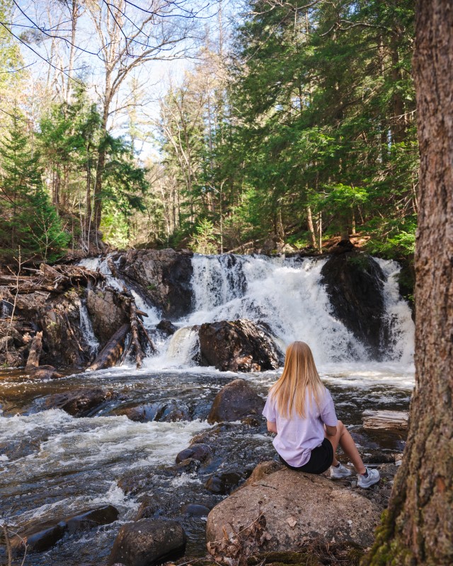
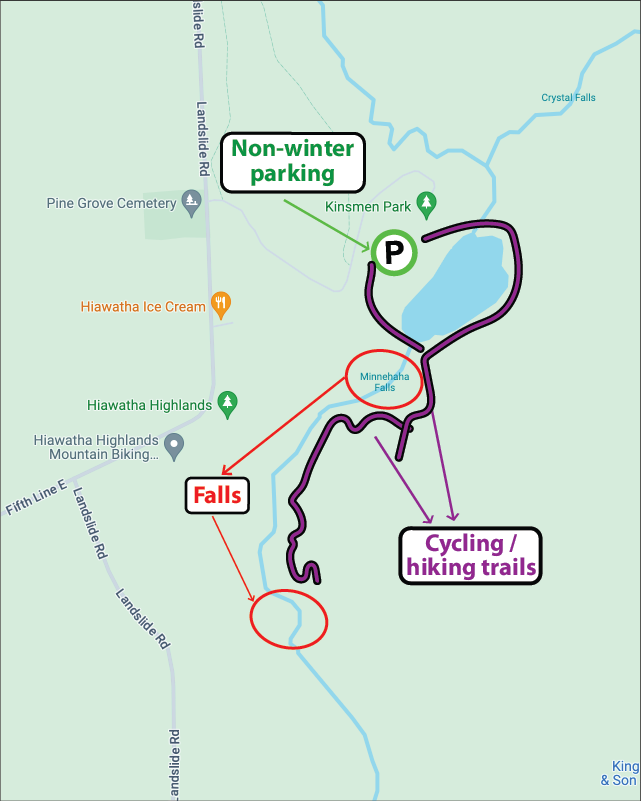
The beautiful Crystal Falls at Kinsmen Park, with a total height of around 80 metres, is one of the most popular visitor spots in Sault Ste. Marie, attracting thousands of visitors each year. Easily accessible from the Kinsmen Park parking lot at Hiawatha Highlands, a boardwalk with handrails leads to the base of the falls with steps leading up to several viewing platforms.
On the other side of Thayer Reservoir, in Kinsmen Park, are the lower Crystal Falls, including the delightfully named Minnehaha Falls. Access to these falls requires a little more work than the higher ones, with some hiking and exploring just off the multi-use cycling/hiking trail TLC, but the rewards are worth it!
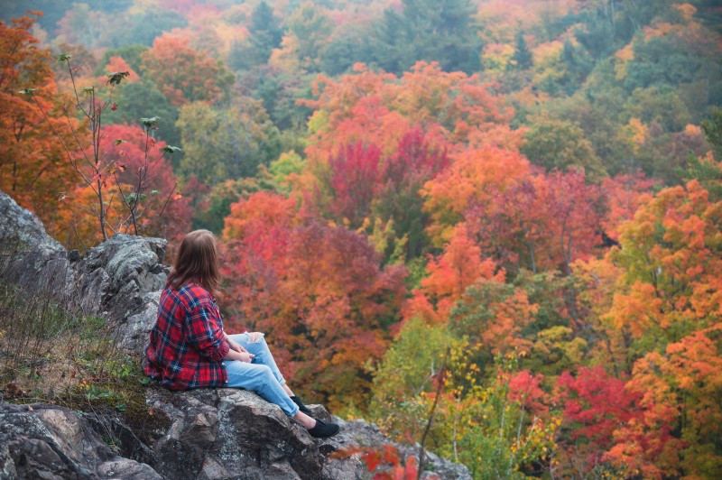
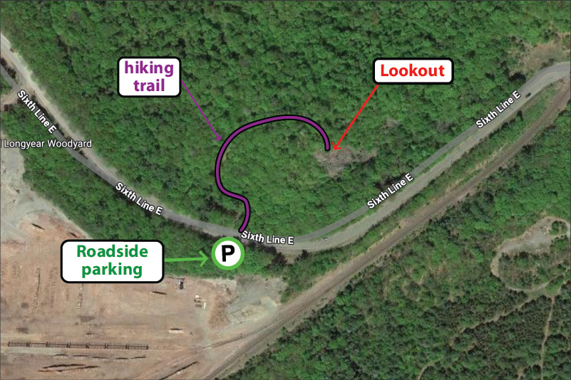
The Odena lookout and Odena Loop at Hiawatha Highlands is part of the Voyageur Trail. The large ‘Loop’ trail is a 4.2km hike that starts at Sixth Line and weaves itself over to Connor Road. Alternatively if you just want to enjoy the incredible view, the Lookout hike is a short 400 metre trot uphill. Once you get to the top the view will take your breath away. Beautiful maple fall colours blended with vibrant coniferous greens make this lookout truly spectacular.
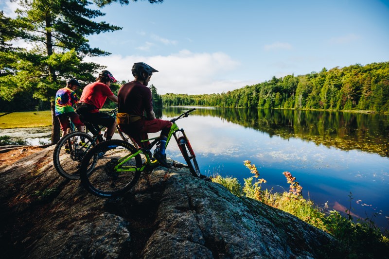
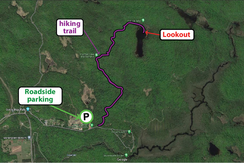
Checkout the Beaver Loop, an out and back 4km loop with a beautiful lookout at Farmer Lake – also part of the Voyageur Trail at Hiawatha Highlands. The trail head is at the end of Connor Road, where there is ample parking, then the trail heads north and east, initially along the route of the Odena Loop before forking off to the right. The trail is a multi-use trail so you’ll find hikers and cyclists alike!
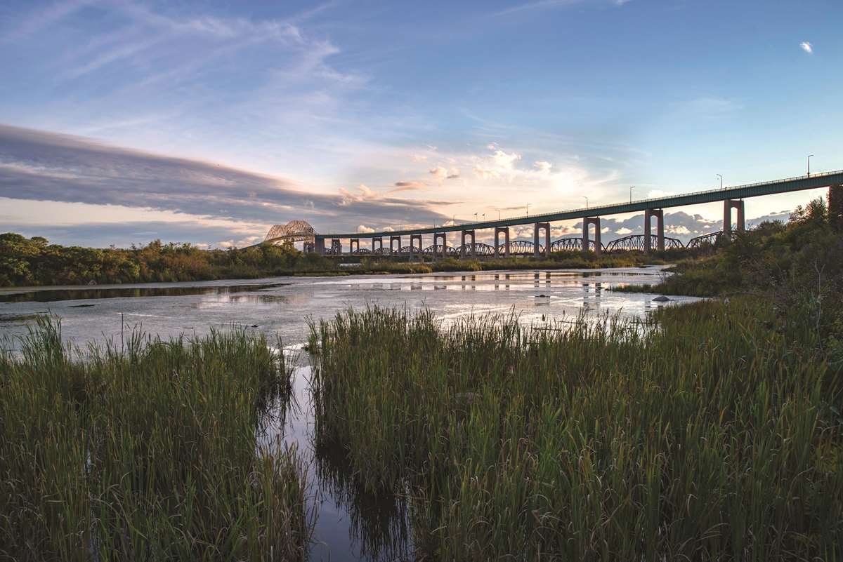
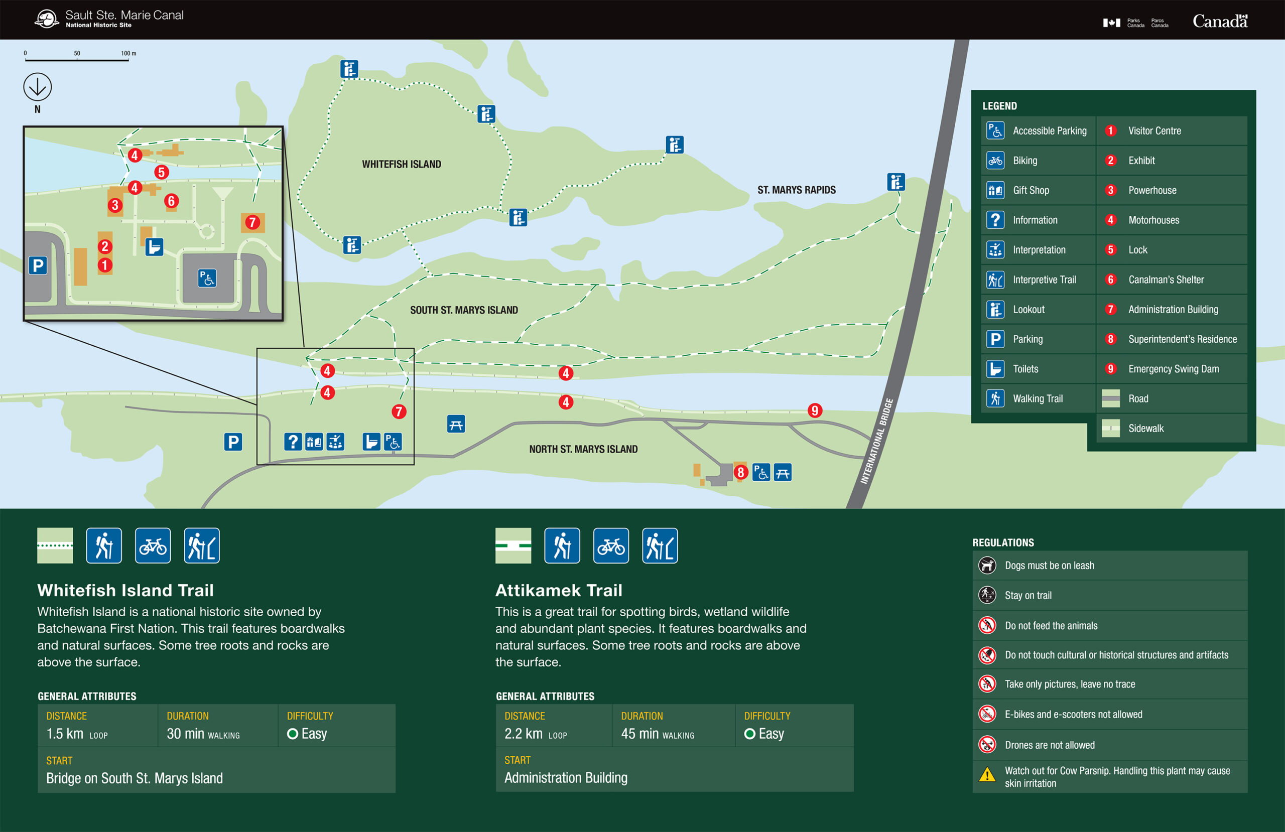
The Attikamek trail on Whitefish Island is a beautiful and easy-paced hike, perfect for enjoying nature. Parking is at the trailhead, located at Sault Ste. Marie Canal National Historic Site, from where you can access the Island across the famous locks. Batchewana First Nation Whitefish Island Reserve is a traditional territory and meeting ground of the Anishinaabe peoples of the Great Lakes due to the abundance of natural resources and fish in the St. Marys River
The lookout at Gros Cap Conversation area is another great spot just outside the city limits. While the tree species here don’t offer the vibrant red and oranges of Hiawatha, you can still enjoy fall tones with incredible views of the place where Lake Superior flows into the St. Marys river, the Gros Cap lighthouse, and any Lake Superior ‘lakers’ that happen to be cruising past.
The lookout is part of the Saulteaux-Goulais section of the Voyageur Trail, which leads west and north towards Red Rock.
How to Experience one of Ontario's best lookout hikes
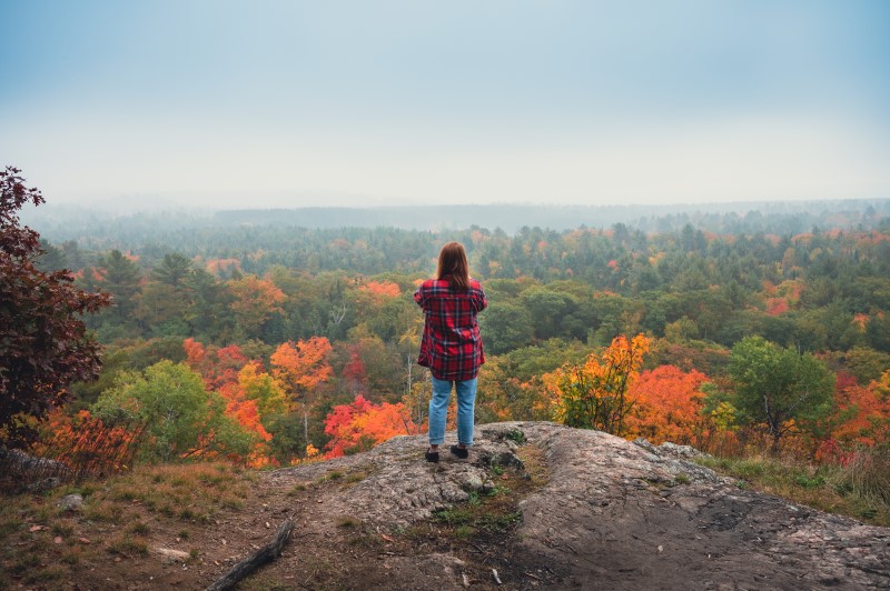
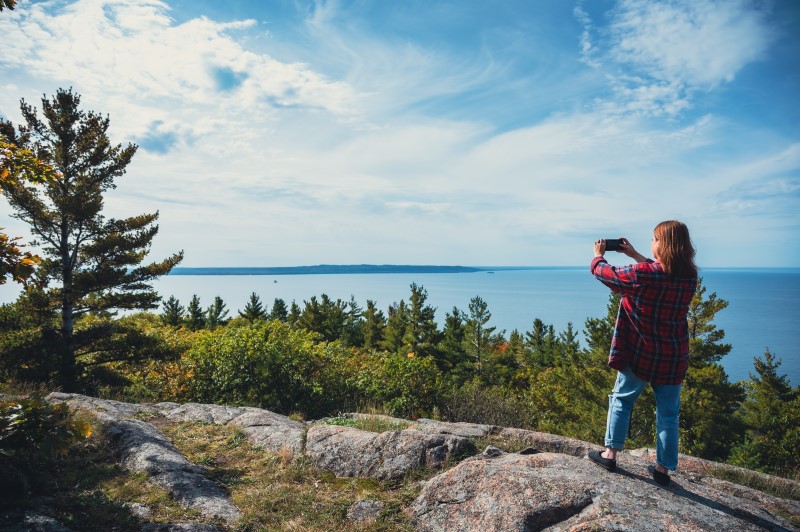
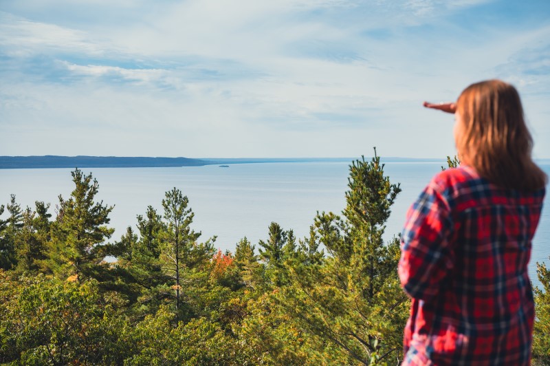
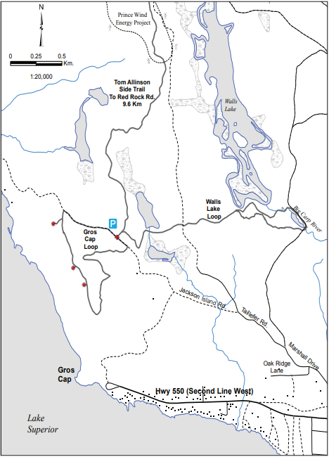
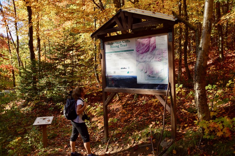
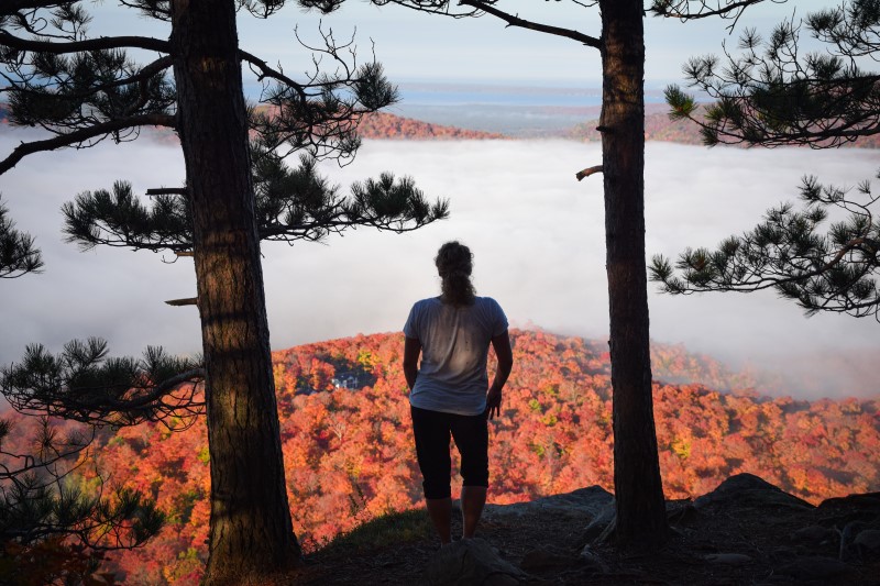
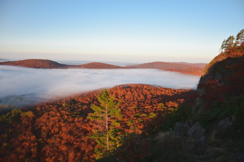
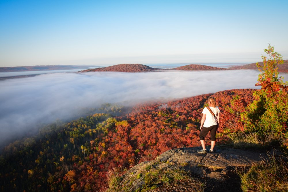
Robertson Cliffs, just 30 minutes north of Sault Ste. Marie, is one of best lookout hikes in Ontario. These cliffs offer views from several incredible lookouts that stretch for miles across Bellevue Valley towards the Goulais River and as far as Lake Superior.
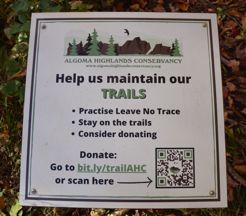
The cliffs are owned and cared for by Algoma Highlands Conservancy, a not for profit organization that is run by local volunteers. Clearly marked trails are maintained through donations and memberships. To support this organization click here.
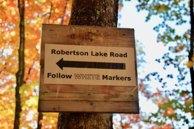
AHC’s Robertson Cliffs are located about 30 minutes north of Sault Ste. Marie, just east of the trans-Canada highway, highway 17. Click here for a Google Maps link to directions to one of the car park areas.
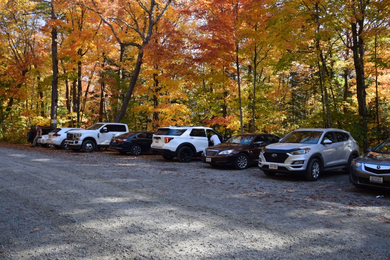
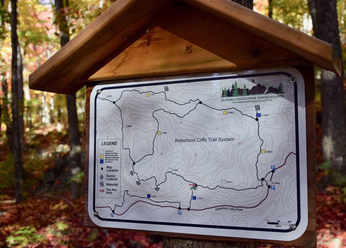
There are three parking areas at the trail heads, these are shown in the below maps.
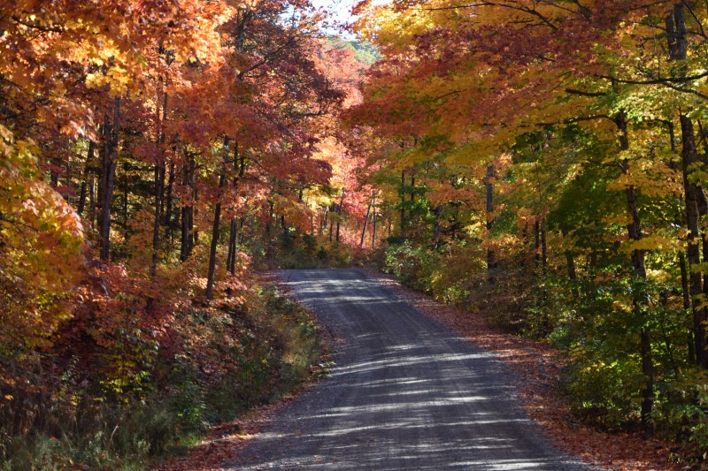
Road to Algoma Highlands Conservancy towards Robertson Cliffs
One of the eastern parking lots
How Long Does the Hike Take and How Difficult Is It?
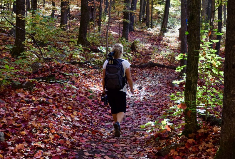
The route to the top can take between 45 minutes and 2 hours depending on which trail you take, and then the same on the way back. So allow yourself at least 2 hours as a minimum.
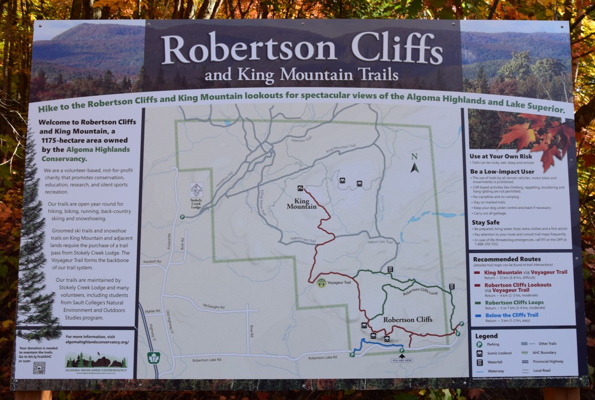
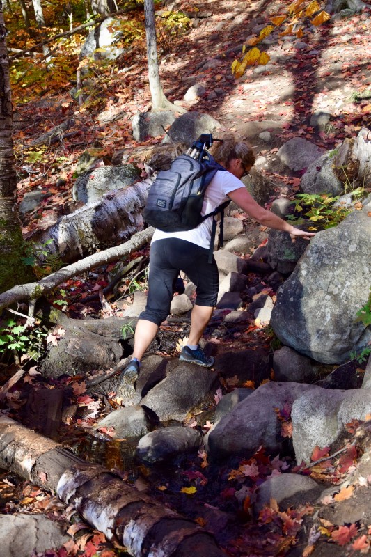
It’s described a ‘moderate’ difficulty because there is some scrambling over rocks, small streams and occasion trees. Click on the below images to see some maps of the area.
Map of local area
Crossing a stream
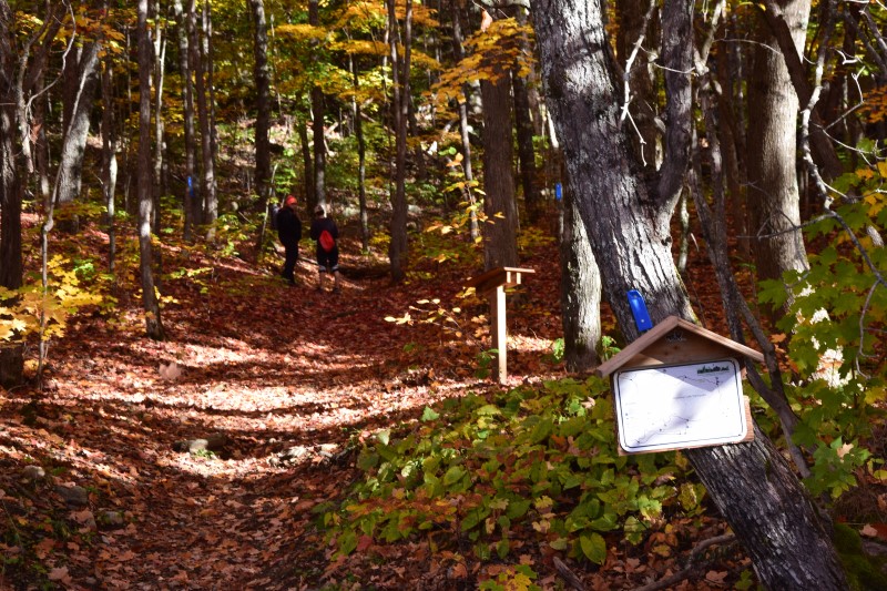
The trail map, easily found along the routes
What Routes are there and Are the trails well marked?
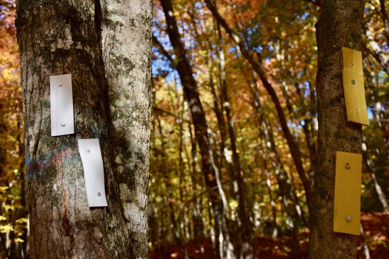
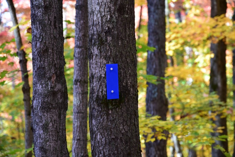
There are 3 routes that will get you to the top. The Blue route is a 300 metre route that links up with the white route. It begins at the western parking lot.
The White route is a 2km, 45 minute route which begins at one of the two eastern parking lots. Well marked trails lead through the Great Lakes St. Lawrence forest before meeting up with the blue trail. Once the blue and white trail meet the trail does get a little steeper as it ascends to the lookout points.
The yellow trail is a longer 2.5km trek that takes you along beautiful waterfalls. Allow 2 hours for this hike to the cliffs.
White and yellow trail, trail head
White and Yellow routes diverge
The Blue route marker
Hiking through the forest
More route signs
Blue route trail-head
What about the lookouts and what is view like?
There are 3 main lookouts with several others you can find along the way too. The views… judge for yourself.
A huge thanks to the Algoma Highlands Conservancy and its volunteers for maintaining these beautiful trails. You can donate or volunteer to the Conservancy here!
Algoma Highlands Conservancy
QR code to donate
With a vast network of trails on land, lake and river, Sault Ste. Marie is Ontario’s best Trail Town
By Sault Tourism
Cradled by the ancient mountains of the Canadian Shield and the biggest fresh water lake in the world, Sault Ste. Marie is home to some of the best trails for hiking, biking or paddling in Ontario.
Hike trails that will lead you to incredible lookout vistas, or along the largest fresh water lake in the world. Bike on newly built machine-cut mountain bike trails, or along some quiet yet beautiful gravel roads. Or paddle one of our many and varied waterways, from winding rivers to portage-friendly inland lakes, or course the Big Lake, Lake Superior. Whatever your own personal mode of transport is, be it foot, peddle or paddle, we’ve got a trail for you.
So keep reading and get inspired by a sample of these routes ready make for hiking, biking or paddling, and learn why Sault Ste. Marie is known as ‘trail town’.
Hiking the Voyageur Trail
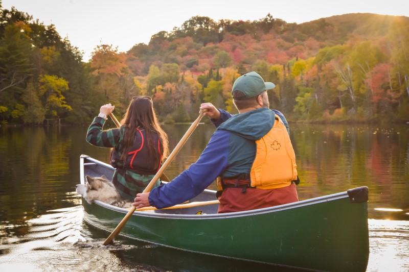
Paddling Inland Lakes
Biking at Hiawatha
Hiking
From the stunning Lake Superior coast to the rugged mountains of the Canadian Shield, Sault Ste. Marie has easy access to a vast network of hiking trails. Our mixed hardwood and conifer forests provide a vibrant canopy of colour in the summer and fall months, and are starkly beautiful and perfectly quiet in winter.
The Voyageur Trail at the Hiawatha Highlands
Length: 20km
Difficulty: easy to intermediate
Must See: Crystal Falls
The Voyageur Trail is a public hiking trail consisting of almost 600km of wilderness style trails in Northern Ontario. The Hiawatha Loop (which goes past the stunning Crystal Falls), Odena Loop, Beaver Loop and Mabel Lake Loop make up around 20km of trails in this area.
This there-and-back trail in the Algoma Highlands takes you past one of best lookout hikes in Ontario, on the way to one of the higher mountains in Ontario. The trail begins at Robertson Cliffs road and takes you to three incredible south and west facing lookouts. From there you head through beautiful maple forests of the Algoma Highlands to King Mountain.
The trails are owned and cared for by Algoma Highlands Conservancy, a not for profit organization that is run by local volunteers. To access maps of the trail system click here.
The Edmund Fitzgerald lookout trail is another trail with a spectacular lookout. This one overlooks Pancake Bay Provincial Park (in which the trail is situated), Lake Superior and even as far as place where the Edmund Fitzgerald ship tragically sunk in 1975.
The trail system has 3 hikes available; 6km, 10.5km and 13.5km, with the latter hikes taking you to waterfalls and the inland Tower Lakes. For further information click here.
For those seeking true adventure, consider this spectacular and rugged coastal trail. It extends from Agawa Bay in the south to Chalfant Cove just north of Warp Bay in the north and will give you a true experience of Lake Superior. Local experts recommend taking 5-6 days because many sections require climbing over rocky headlands and cobble beaches, which can be technically challenging and require a steady pace for safety.
There are various spots for beach camping along the trail; you’ll enjoy incredible coastal scenery during the day and perfectly dark starry skies from your beached down tent at night.
Nestled between the Great Lakes, Sault Ste. Marie has wild rivers, majestic channels, hidden coves, stunning waterfalls and, of course, more freshwater lakes than you could ever count. Here are 4 mouthwatering paddling routes to wet your appetite.
There are a number of entry points to the river including Pine St. Marina, Bondar Marina and the Waterfront Adventure Centre (which has rentals). A paddle west will take you to the historic canal, rapids and International Bridge. East will take you towards Bellevue Park and Topsail Island. Keep an eye out for the formidable Lake Superior ‘Lakers’ who use this waterway daily.
Lake Superior is a huge draw for paddlers, and the Water Trail maps out the 1,000km Canadian route from the Bobbi Bennett Memorial Park in Gros Cap to Lorne Allard Fisherman’s Park in Thunder Bay. Paddling west from Gros Cap’s entry point provides an immediate glimpse of Lake Superior’s rugged shoreline; you’ll see spectacular cliffs, gravel beaches and a vast, open horizon along the 10-km section to Red Rock.
A backcountry paddler’s dream; 70km of winding river from Witchdoctor Lake in the heart of Algoma to Lake Superior’s Goulais Bay just north of Sault Ste. Marie. The full route can take up to 5 days with numerous portages to get past some pretty lively waterfalls. A logging road leads to the Witchdoctor Lake, though there are of course many other entry points. For a half day paddle consider starting at Mountain View Lodge and paddling to Kirby’s Corner in Goulais. This section includes Class I and II rapids, as well as plenty of swift water, making it suitable for novice whitewater paddlers. Paddling in spring or fall is best when water levels are high.
Must See: Tiny moss-topped islands perfect for camping
The Jarvis Circle Route is a perfect inland-lake paddling route, and with all the shore-lined maple trees, a great route to paddle in the fall. The full loop is 30km long, with fifteen rugged portages along the way varying from 50 to 750 metres. You start and end at Northland Lake then take a clockwise or anticlockwise route through numerous small lakes including Jarvis, Reserve and Clearwater.
Check out this great video below:
Biking
Sault Ste. Marie has world-class mountain biking trails on newly machine-built flow trails as well as challenging cross country climbs over the Canadian Shield. For gravel riders we have flat open gravel roads where you can burn through the kilometres while enjoying picturesque Northern Ontario countryside.
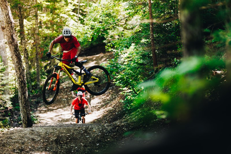
Mountain Bike trails at Hiawatha
Length: 40km
Difficulty: easy to intermediate
Must See: Newly built trail ‘Berm Baby Berm’
More than 40km, over three unique systems; Crystal, Red Pine and Pinder. A mix of newly machine built trails, and older traditional single-track trails, alongside (and over) beautiful creeks, waterfalls and towering forests. Trails are available for all skill levels, plus there is a new skills park!
This 7km out-and-back trail through the stunning Canadian Shield will take you to the beautiful Farmer Lake. Navigate the technically challenging Climb to Canyon section, climbing almost 50 metres, then take on the many berms and hairpin turns of Farmer Lake trail. On the way back advanced riders may want to test their skills on the new Crazy Train trail; an adventurous and aptly named downhill trail which has enough vertical to keep any adrenalin junky interested.
Just east of the city is the relatively flat and fertile Sylvan Valley, with almost endless kilometers of picturesque and winding gravel and backcountry roads. One popular day ride, at around 140km is the Rock Lake loop. The route threads through Sylvan Valley road, south along McCarrel Lake, circles Otter Lake then back north past Rock Lake, before returning to Sault Ste. Marie. Of course, Google maps and the many plan-your-route apps means you can tailor any version of this route to your own tastes.
Needing to get outfitted? We have plenty of stores with the latest and best equipment to help you out. Visit our Outfitters page for more info.
By Tourism Sault Ste. Marie
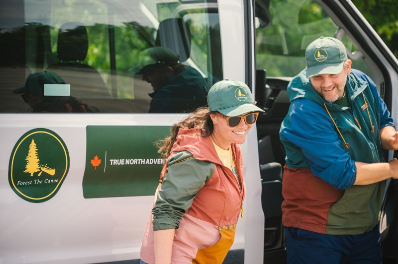
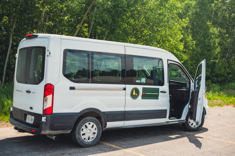
Experience Spectacular Fall Colours with the True North Adventure Bus
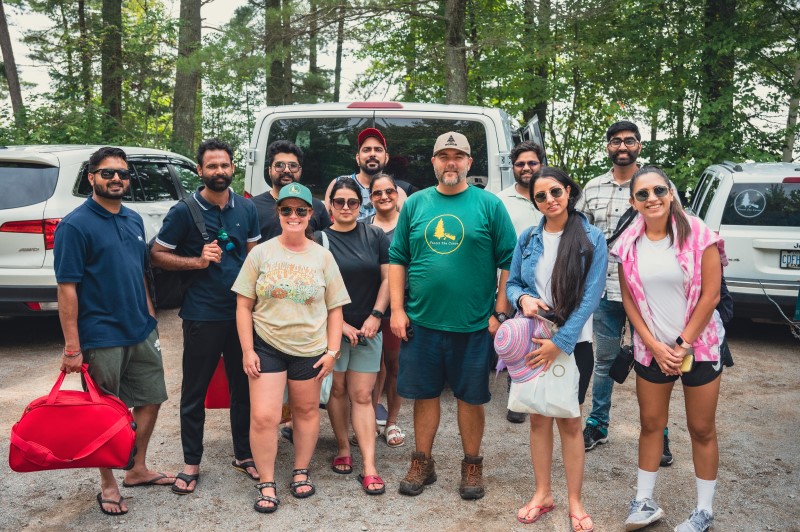
Forest The Canoe are offering a variety of guided tours to see some of the best fall colours in Ontario. The True North Adventure Bus has full day, morning and evening guided tours running in September and October.
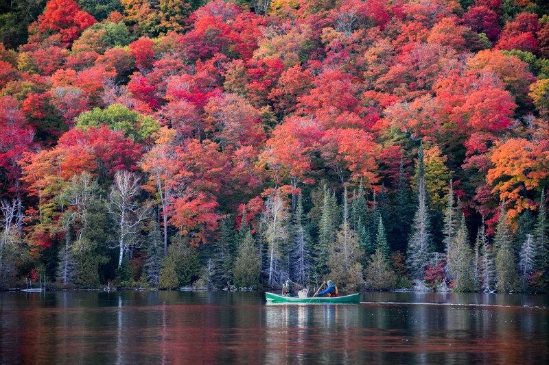
Witness the stunning fall colours you’ve seen on Instagram. Paddle beautiful inland lakes. Hike up the iconic Robertson Cliffs to witness a stunning vista of autumn colours that stretch as far as Lake Superior.
Contact experienced tour guides Forest The Canoe to see some of the most beautiful fall colours in Ontario. Ride the True North Adventure Bus this fall, with daily tours departing from Sault Ste. Marie.
Four fall colour tours are offered on the True North Adventure Bus, each a truly unique adventure, and a each chance to see and explore a different part of Northern Ontario. Tours last a full day, a morning or an evening with pick ups from local hotels in Sault Ste. Marie throughout the day.
Friends of Fall Colours
Explore the autumn colour change by water and land. Tours run 9.30am – 6.30pm.
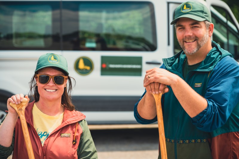
Sit back and enjoy the drive, that’s all you’ll have to do with the True North Adventure Bus. Expert, certified tour guides Ryan and Shana provide informative narration to help you get the most of your experience. Enjoy your day with all the quality equipment and safety information you will need.