Forest The Canoe are offering a variety of guided tours to see some of the best fall colours in Ontario. The True North Adventure Bus has full day, morning and evening guided tours running in September and October.
Witness the stunning fall colours you’ve seen on Instagram. Paddle beautiful inland lakes. Hike up the iconic Robertson Cliffs to witness a stunning vista of autumn colours that stretch as far as Lake Superior.
Contact experienced tour guides Forest The Canoe to see some of the most beautiful fall colours in Ontario. Ride the True North Adventure Bus this fall, with daily tours departing from Sault Ste. Marie.
Four fall colour tours are offered on the True North Adventure Bus, each a truly unique adventure, and a each chance to see and explore a different part of Northern Ontario. Tours last a full day, a morning or an evening with pick ups from local hotels in Sault Ste. Marie throughout the day.
Friends of Fall Colours
Explore the autumn colour change by water and land. Tours run 9.30am – 6.30pm.
Sunday, Sept 18th,
Friday, Sept 23rd,
Saturday, Sept 24th,
Sunday, Sept 25th,
Saturday, Oct 1st,
Sunday, Oct 2nd,
Wednesday, Oct 5th,
Friday, Oct 7th,
Friends of Fall Colours: Lite Edition
A micro version of Friends of Fall Colours. Tours run 4.30pm – 9.30pm
Wednesday, Sept 21st
Monday, Oct 3rd
Chase The Train
Chase the train all the way to Searchmont, then explore a beautiful waterfall on the Goulais River. Tours run 8am – 12.30pm.
Thursday, Sept 22nd
Monday, Oct 3rd
Tuesday, Oct 4th
Thursday, Oct 6th
Coastal Fall Colours at Sunset
Experience breathtaking views of Algoma Highlands along the greatest lake all the way to Montreal River. Tours run 5pm – 9.30pm
Thursday, Sept 22nd,
Monday, Sept 26th, Thursday, Sept 29th
Tuesday, Oct 4th,
Thursday, Oct 6th,
Sit back and enjoy the drive, that’s all you’ll have to do with the True North Adventure Bus. Expert, certified tour guides Ryan and Shana provide informative narration to help you get the most of your experience. Enjoy your day with all the quality equipment and safety information you will need.
Lake Superior Provincial Park Visitor Centre is located at the south end of ‘the Park’, as locals call it, roughly halfway between Sault Ste. Marie and Wawa, and just above the Montreal River. The drive up the coast from Sault Ste. Marie makes for a perfect daytrip, with several worthy stopping points along the way. More about this is available at the bottom of this article.
The park is known for its 150 km of maintained canoe routes, 11 hiking trails of over 130 km, fishing for Lake Trout, Rainbow Trout, Salmon, and backcountry camping. There are 163 backcountry campsites in Lake Superior Provincial Park which are divided into 76 zones. You can get all the information on it by visiting the website here.
The visitor centre is a great stopping point, with lots of information about the area, helpful staff and a fascinating recount of the history of Lake Superior.
As you enter the visitor centre you are greeted by a beautiful high-ceilinged room with an information desk, map of the area, notice board of daily information and bathrooms.
A short walk takes you a room filled with interactive displays that highlights the “Power of Lake Superior” as well as the park’s cultural history and natural ecosystems. You’ll also find a display about the Group of Seven, a replica lighthouse, plus there are large number of buttons and knobs for kids to press – perfect for a raining day activity for the little ones 🙂
The visitor centre is located on Agawa Bay beach, and there are some beautiful trails that lead to the water and the surrounding area. Located close to the entrance you’ll also find a Group of Seven easel, just one of many on the ‘Moments of Algoma’ Group of Seven Driving Tour.
Just behind the information desk there is a gift shop with lots of interesting souvenirs and apparel, and all Lake Superior themed of course.
A short drive north takes you to the Agawa Rock Pictographs. A clearly marked sign on the highway directs visitors to a parking area at the trail head – map coordinates here.
The trail to the site of the Pictographs is short but rugged; it contains slippery steps and rocks to climb over and around – so take care!
The Agawa Rock Pictographs is one of the most famous pictograph sites in Canada and is one of the most visited indigenous archaeological sites too. It is a sacred site where generations of Ojibwe have come to record dreams, visions and events. Please respect and preserve the pictographs by not touching the paintings.
The images visible today, include canoes and animals such as moose, deer, bear and caribou. The most recognizable painting consisting of a spined-horned animal said to be “Misshepezhieu”, or the Great Lynx, the spirit of the water. Read more about this important area here.
The Visitor Centre in the Provincial Park is just one stop of many on the beautiful Lake Superior coastal drive.
Heading south you may wish to make your next stop the Edmund Fitzgerald Lookout Trail in Pancake Bay Provincial Park. A beautiful view across a luscious maple forest all the way to the Superior coast reward those who hike the 6 km round trip. You may also see the final resting place of the Edmund Fitzgerald ship.
Beautiful souvenirs and ice-cream treats are available at Agawa Crafts and the Canadian Carver further south and The Voyageur Lodge also has some great souvenirs and food options. Chippewa Falls, the famed halfway point on the trans-Canada highway is a great spot for a break. The falls are right beside parking lot, just off the highway. Check out another Group of Seven art easel while you are there.
The Edmund Fitzgerald lookout trail, in Pancake Bay Provincial Park, is the perfect day trip activity from Sault Ste. Marie.
Just an hour north of the city, it’s one of the best lookout hikes in all of Ontario. A beautiful woodland walk through towering maple trees leads you to spectacular views of Lake Superior, as far out as the resting position of the Edmund Fitzgerald ship.
Quick Trail Facts
The trail is great for birding, hiking, and running, offering a mix of smooth paths and slightly more challenging sections near the end. The staircase is the toughest part, but it’s manageable at a steady pace.
The Edmund Fitzgerald Lookout Trail is just a few minutes north of Pancake Bay Provincial Park along Highway 17. There’s ample parking about 100 metres off the highway. Click here for Google Maps directions.
Since the trail, parking, and trailhead are all within the park, a day-use fee applies. You can buy your daily vehicle permit online in advance – both Pancake Bay and Batchewana Bay are both currently offering the advance daily permit online. And of course by buying a day pass you can have a swim at the beach after your hike!
A clearly marked trail-head sign with route information and a map marks the start of the trail. The hike to the lookout and back is around 6km and takes 2-3 hours. Longer side routes are available taking you to Pancake Falls or Tower Lakes.
The route to the lookout is a mix of flat hiking through forests, with some occasional up hill sections. All trails are well maintained by Parks Ontario crew!
The trails are clearly marked with blue signs, and there are maps at each trail intersection. The trails is described a ‘moderate’ difficulty because there may be some scrambling over rocks or small branches.
The most strenuous part of the trail is the climb up the wooden stairs to the lookout itself…
TOP TIP – Spend a few minutes reading the information sign in the middle of the climb as a way to gather your breath before the final ascent.
There are a couple of lookouts before you reach the actual top… and when you reach the top the views are simply stunning.
You’ll be back at your car in no time, ready for a scenic drive south to Sault Ste. Marie. Along the way, stop at Agawa Crafts and the Canadian Carver for ice cream and unique souvenirs, or grab one of the famous apple fritters at the Voyageur Lodge.
Chippewa Falls is another great stop—just off the highway, with the falls right beside the parking lot. While you’re there, take a moment to check out the Group of Seven art easel.
And as you drive, you might just find yourself planning your next visit in a different season…
Picture this view in the fall… 🙂
The trail is 6.1 km (in & out) and takes around 1 hour 30 minutes to complete at a moderate pace
This is an easy hike with a well-maintained trail. There are some exposed roots and a staircase near the end, but it’s manageable for most hikers.
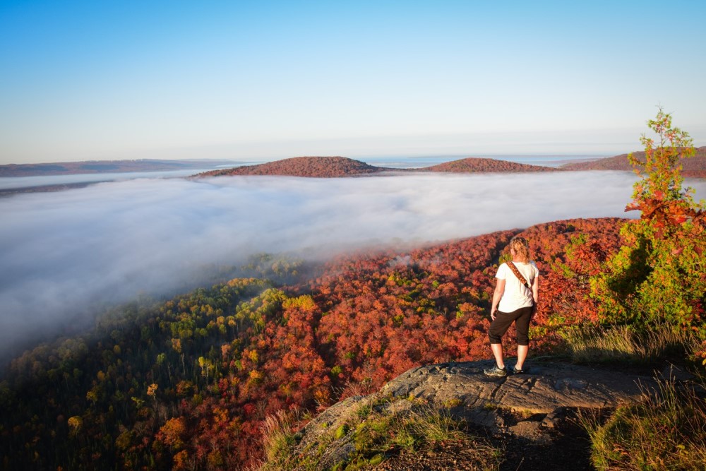
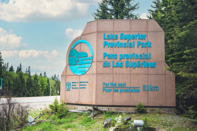
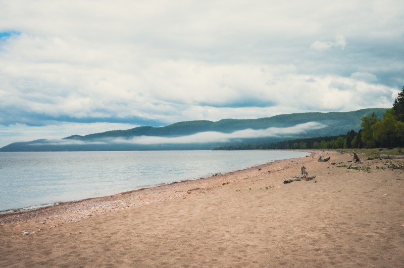
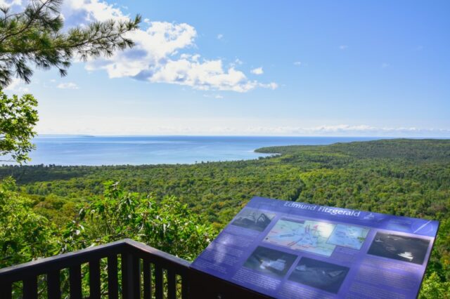
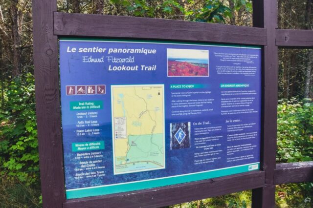
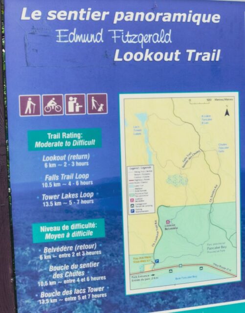
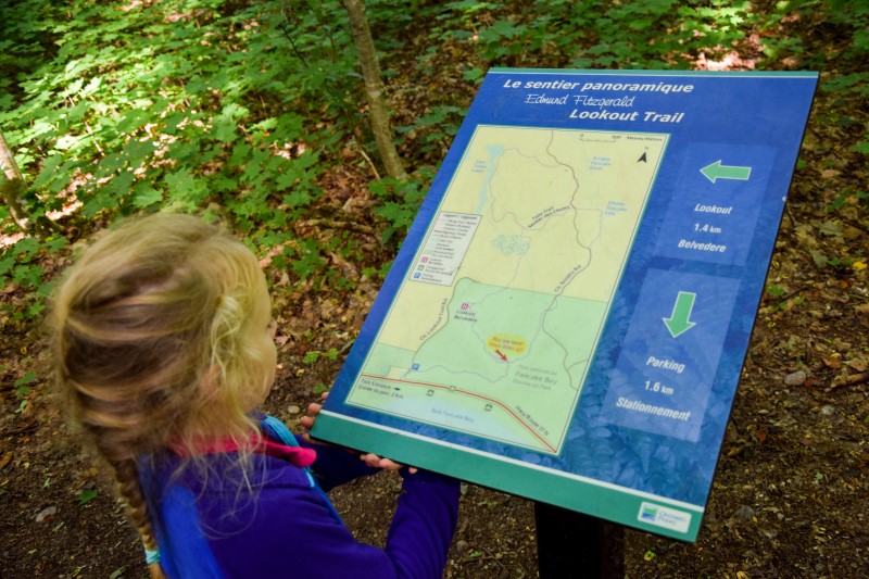
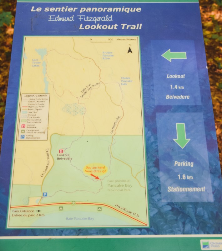
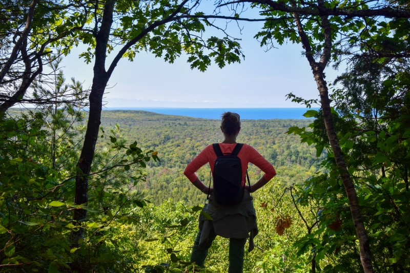
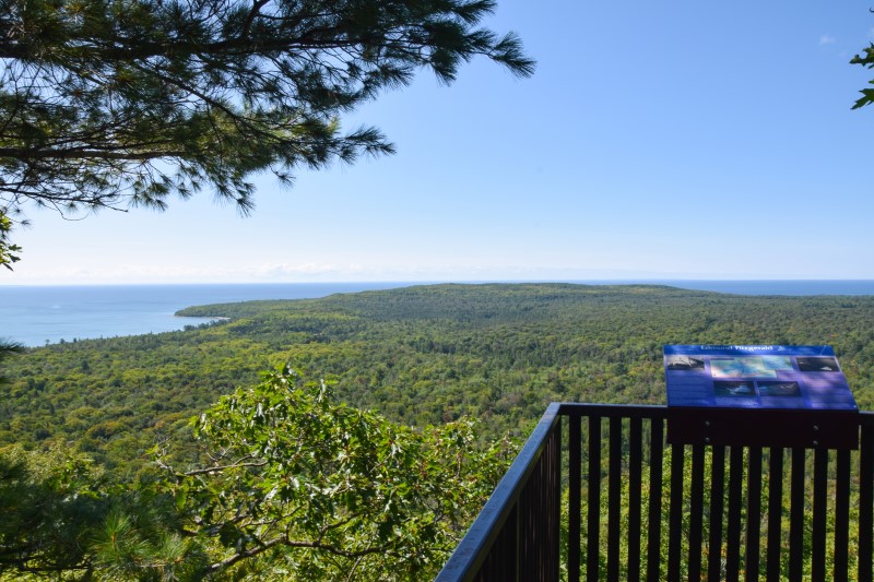
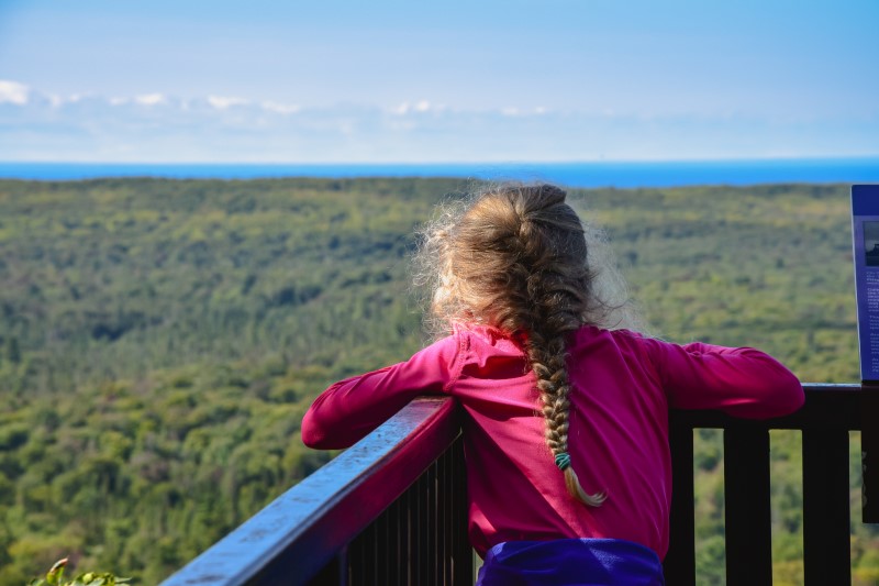
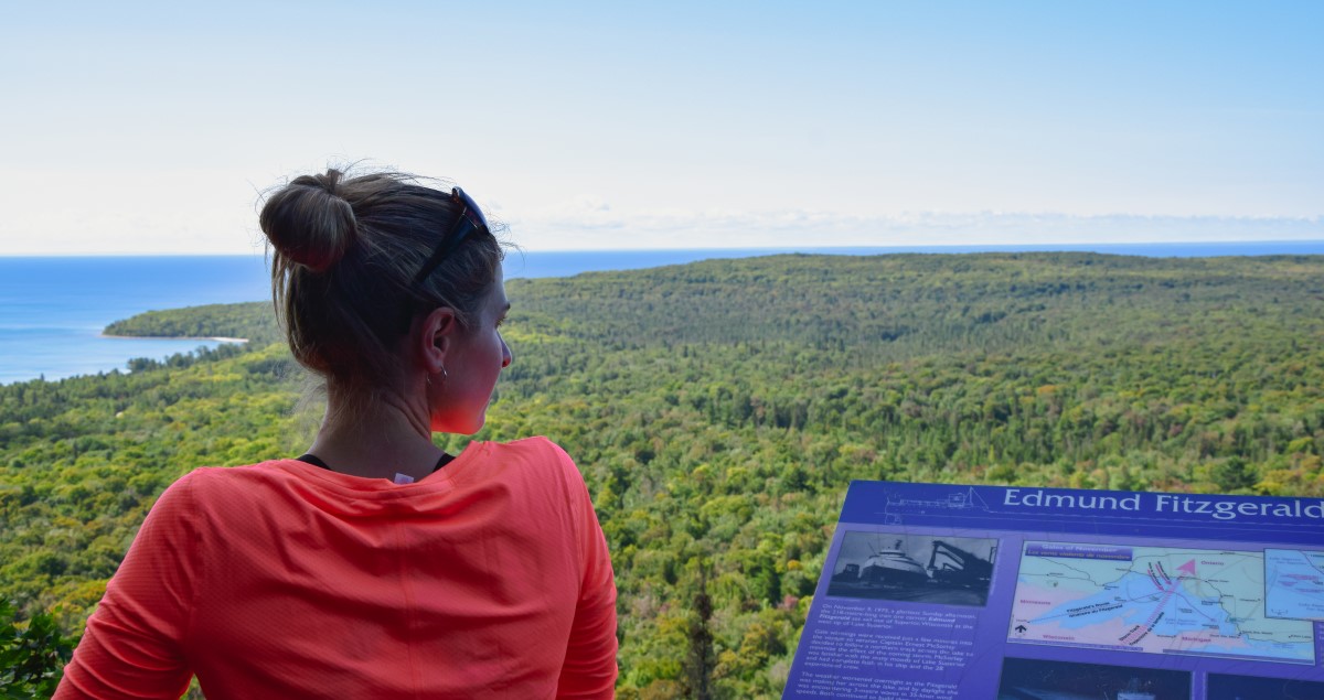
If you’re traveling from outside Northern Ontario, the Edmund Fitzgerald Lookout Trail is easily accessible via Highway 17.
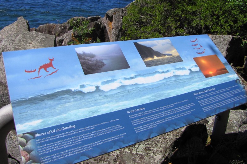
It is located in Pancake Bay Provincial Park, about 35 km north of Sault Ste. Marie.
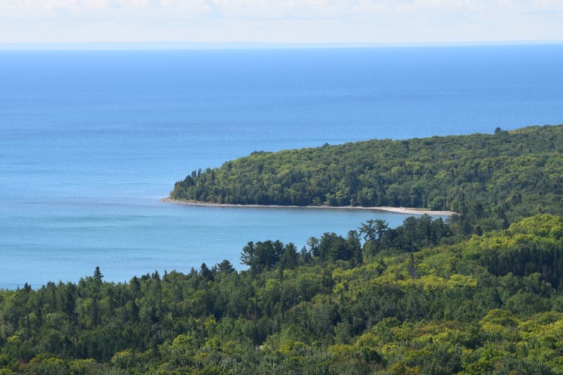
You can also access the park by bus or car from nearby cities, with scenic routes offering beautiful views of Lake Superior along the way.
Yes, the trail is within Pancake Bay Provincial Park, so a day-use fee applies. You can buy your daily vehicle permit online.
The best time to visit is April through October for optimal weather and trail conditions
The lookout offers stunning panoramic views of Lake Superior and overlooks the resting place of the Edmund Fitzgerald shipwreck.
Are you interested in going to a powwow but not sure about going on your own? Thrive Tours, an Indigenous-owned and operated guide company, offers Learn to Powwow Tours in the Sault Ste. Marie area. These tours introduce non-Indigenous tourists to powwows and will teach you everything you need to know.
Our family was able to join Brad and Amanda, owners of Thrive Tours, on a Learn to Powwow Tour and had an incredible experience together! Our tour group included Sault Ste. Marie locals, Ontario tourists and travelers from around the world. We came together as a group of all ages to learn to powwow and experience a celebration of Indigenous culture.
Our tour began with an introduction to powwow history, tradition and etiquette. Our guides taught us the cleansing practice of smudging and invited us to participate in this traditional ceremony. Along with our guides, we also had special guests from the Indigenous community come and speak to us.
When settlers came in, the local Indigenous people were no longer allowed to practice their culture. The sacred ceremonies and songs had to continue deep in the bush and underground. Despite this oppression, the tradition and the heartbeat of the drum carried on and continues today. Although often looked on as traditions of the past, Brad shared with us that they “are not people of the past, but people with a past. [We] have an amazing history and an amazing future!”
During our introduction we were also honoured to have Chief Dean Sayers of Batchewana First Nations come and speak with us. He shared some of the history of the Indigenous people of the Sault Ste Marie area, also referred to as Bawating, meaning ‘place of the rapids’. Chief Sayers welcomed us to come on in and celebrate!
Lucia, who has been dancing at powwows since she was a young girl, shared with us the dos and don’ts of the powwow. She told us that it is customary to stand at the beginning of the powwow, as a sign of honour, while the dancers enter the circle during the Grand Entry. Taking photos and videos during the Grand Entry is not allowed, but Lucia shared with us the proper way to take photos at other points during the powwow.
Our guides explained to us the different types of powwow dancing and the significance of the dancers’ attire, called regalia. Our guide Brad is a powwow singer and drummer who has been powwowing for about 15 years. He shared with us the history and significance of drumming and how the beat of the drums honors the heartbeat of Mother Earth.
After our time of learning we went as a group to the powwow. On our way to the circle we passed by the sacred fire. This fire is lit before the powwow starts and burns until the end. Fire keepers sit around the fire to make sure it continues burning. We honored them and the fire by putting tobacco in the fire and saying ‘Miigwetch’, which means ‘thank you’.
The powwow we attended, Gathering at the Rapids at Algoma University, was an indoor Competition Powwow (differing from a Traditional Powwow). There were a number of drum groups and dancers of all ages competing in different categories. As we entered the building, the Grand Entry was underway. We could feel the heartbeat of the drums resonate within us and stood as the dancers entered the circle. The intricate designs of the dancers’ regalia was amazing to see – bright colours, feathers, tassels, beading and jingling cones. After representatives carried in flags and veterans were honoured, the competition began.
We listened and watched as different drum groups took turns singing and drumming while the dancers made their way around the circle. We saw different categories of dances – traditional, jingle, grass, fancy – and watched as each age category took their turn, from the tiny tots to the golden age dancers. Our guides were available throughout the powwow to answer any questions we had and shared more information with us about the different dances.
One unique experience that we had not been expecting, was the opportunity to join in on the dancing! Throughout the powwow there are inter tribal dances, where everyone from every background is invited to come into the circle and dance. Our children have been learning about Indigenous culture and powwows in school and to actually be there and take part was a very special experience.
In addition to the drumming and dancing, there were also Indigenous vendors set up at the powwow. We admired the handmade goods, enjoyed some lemonade and ate delicious food!
As a non-Indigenous person, I’ve been hesitant about attending a powwow in the past. I didn’t know what the proper etiquette was and didn’t want to be disrespectful in any way. It was so great having our guides from Thrive Tours to show us around and answer all of our questions! The whole powwow environment was one of total inclusivity, positive energy and people coming together to celebrate!
There are several Powwows during spring and summer in and around Sault Ste. Marie, and if you are interested in going you’ll definitely want to check out Thrive Tours’ Learn to Powwow Tours. Learn about the history, people, food and traditions; dancers, drums, singers and teachings. Half or full day experiences are available. Contact Thrive Tours for more info.
And read our other blog post from summer 2022 about spending a day exploring Indigenous culture with the family in Sault Ste. Marie here!
By Sault Tourism and Canadian Cycling Magazine
Canadian Cycling Magazine and Charlotte Batty from Minii Adventures spent a couple of days checking out our new trails, because we think that Sault Ste. Marie is the perfect place to spend a weekend mountain biking! So check out this awesome video above by Canadian Cycling Magazine, then continue reading below, and finally, start planning your awesome adventure here in the Soo!
Sault Ste. Marie has some of the best mountain bike trails in Ontario, and we’ll talk more about them in a second, but did you know that these trails are just ten minutes from downtown? So you can be riding hard one minute then relaxing at a microbrewery almost the next. This combination of awesome trails and close proximity to the city is what makes Sault Ste. Marie the perfect mountain biking destination.
We recommend you start your mountain biking adventure on the newly constructed Farmer Lake trail (trail forks map here). It’s a 7 km out and back trail through the stunning Canadian Shield that will eventually take you to the beautiful Farmer Lake. Before you get there you are going to have to navigate up the rocky Climb to Canyon section, a new modern flow XC trail that is a fun test of your technical skills. With your heart pumping hard from climbing the almost 50 m hill you’ll then be met by the many berms and hairpin turns of Farmer Lake trail. Finally, you’ll descend to reach the beautiful oasis that is lake the trail is named after.
On the way back advanced riders may want to test their skills with on the new Crazy Train trail; an adventurous and aptly named downhill trail which has enough vertical to keep any adrenalin junky interested.
Catch your breath after that, but not for long because the end of the Farmer Lake system is one of the jumping on points for the popular Crystal System (trail forks map here). The Crystal is what everyone is talking about up here in the Soo; we added 12 km of new machine built flow trails here last year bringing the total to over 20. You can ride alongside (and over) beautiful creeks, take in some spectacular lookouts, or simply enjoy the rollercoaster experience of new flow trails such as Berm Baby Berm.
The Crystal really has something for every ability, and with so many trails and combinations of trails, you can easily spent a day here alone.
The Farmer Lake and Crystal systems make up just over half of the trails at Hiawatha Highlands, with the Pinder and Red Pine System completing the list (trails forks link to Pinder and Red Pine). The Pinder has roughly 8 km of green rated single track, so it’s perfect for beginners or families with young riders. Then there’s the Red Pine system, which at 15 km long, is a bit tougher with more elevation, but still has a wide array of trails. The Red Pine is a combination of blue / black trails and great diversity of single track trails, transporting you from the historic beginning of MTB to new modern hand-built fun-flow trails like Stickman.
There’s only so many mountain bike trails a regular person can ride and after a day and a half at Hiawatha, you may feel like cranking the pace down a touch. If so, the Hub Trail could be the perfect ride for you. It’s a 22.5 km easy loop of the city where you can ride at your leisure and soak up the sights. You’ll pass some of the well-known tourist spots like Fort Creek, the famous locks between Lake Superior and Lake Huron and the beautiful St. Marys River waterfront.
The Fort Creek Conservation area is a beautiful spot with three bridges giving you incredible views of the creek and surrounding forests. Continue south through the city to the Canal District and Machine Shop area. This area has been restored from a previous industrial area to become one of the hottest parts in town for great food and drinks. Delicious pizzerias, cozy pubs or fine dining can all be found in one centralized area. The vibe of the Canal District is warm and inviting and perfect after a day of riding.
Take a side-trip along Whitefish Island’s boardwalks and trails where you will get a spectacular view of the international bridge as well as the famous Sault Ste. Marie rapids.
Back on the Hub Trail and riding along the waterfront you might notice some of the many pubs and restaurants in the area. Fluid Restaurant has great food as well as beautiful views of the rivers. At the Bondar Pavilion you can hop on a 2-hour river cruise of the newly launched Miss Marie Sault Locks boat. Or if you’d like to enjoy the waterfront a different way, visit the Waterfront Adventure Centre. The WAC rents canoe, kayaks and SUPs; great for exploring the waterfront.
By now though you may be craving some great post-ride hydration, and the Soo has a great pick of watering holes. Outspoken Brewing and Northern Superior’s Tap Room are great microbreweries if you’re looking to try some local suds. Both often have local bands playing and the vibe is great!
So consider a mountain biking trip to Sault Ste Marie. Come with friends, come with family, come by yourself. Ride our awesome new trails and stick around after and check out the sites of the city!
Thanks again to Canadian Cycling Magazine and Charlotte Batty from Minii Adventures!
Whether you’re road-tripping through Northern Ontario or looking for somewhere to get away for the day, Sault Ste. Marie is the perfect place for family adventure! There are so many exciting things to do in Sault Ste. Marie, from biking and boating to eating delicious treats and enjoying local artwork! With all these great places to visit in Sault Ste. Marie (nicknamed “the Soo”), this will be a day that everyone in the family will love!
Start your day off with some coffee from The Machine Shop and then head over to the Soo Canal. When the lock was built here in 1895, it was the longest in all of Canada. Today, pleasure watercraft are transported up and down the river through the lock to bypass the St. Marys River Rapids. Here you can enjoy watching the boats lock through as you walk along the canal.
Next, grab your bicycles and get ready to explore the Sault Ste. Marie waterfront. Bikes can be rented at the canal or from the Roberta Bonda marina in town during summer months.
Take one of the bridges across the canal lock gates to get over to Whitefish Island. Bike or hike along trails and boardwalks as you take in views of the rapids along St. Marys River. You can learn about the island’s culture and history by reading the information signs along the trail. Make sure you also keep a lookout for the fairy doors painted around the island!
The main loop will take a family with young kids around 45 minutes to complete by bike or an hour hiking. Side trails are available if you want to extend your adventure – like going under the international bridge! There are plenty of trail maps to keep you on track.
After exploring Whitefish Island, you can continue your bike ride or stroll along the John Rowswell Hub trail. This beautiful trail & boardwalk provides you with amazing views of the St. Marys River as you pass significant landmarks along the waterfront. Stop to eat a sweet treat at BeaverTails located right on the boardwalk and enjoy the lively atmosphere.
The whole loop is 22.5km and a great ride for the adventurous family, but equally, you can divide and conquer smaller sections too. The Fort Creek section is a beautiful 6km there-and-back trail with three awesome bridges that take you high over the ravine below. Parking is available at the south end.
Next, head into town to get some lunch or continue along the Hub Trail to Bellevue Park to enjoy a picnic. With 7 separate playground structures, Bellevue Park is a kid’s dream come true. Along with its impressive playgrounds, the park also includes a splash pad, beautiful paths along the waterfront and picnic areas.
Now it’s time to experience Sault Ste. Marie from the St. Marys River! You can launch your canoe or kayaks from the accessible boat launch located at Bellevue Marina, making it easy for you to get in the water and explore the river. Don’t have your own boat? No problem! Canoes and kayaks can be rented from the Waterfront Adventure Centre or from Thrive Tours who operate from the same building.
After enjoying your time on the water, head downtown to see the incredible mural artwork around Sault Ste. Marie. These murals have been painted by local and visiting artists, adding vibrant character to the city! If you are visiting during the month of June, you can watch new murals being painted as part of the Summer Moon Festival.
While you’re downtown, be sure to stop by Elliot’s Ice Cream for a treat that not only tastes delicious but also looks like a work of art!
Crystal Falls is located in Kinsmen Park at the North edge of Sault Ste. Marie. The falls are a short walk from the parking lot and can be accessed by walking along a wooden boardwalk. The amazing views keep coming as you walk up a series of steps to viewing platforms and experience the many layers of this waterfall.
If you have time, you can continue your hike along some of the many great trails nearby into the Hiawatha Highlands and the Voyageur trail system.
Now it’s time to relax while eating supper at one of the many delicious restaurants in town. Finish off your day by watching the sunset over the St. Marys River and then get some well deserved rest at one of Sault Ste. Marie’s hotels.
After such a great day of family fun and activities, the whole family will want to come back and do it all again! Sault Ste. Marie is the perfect place for family adventure.
Check out more Adventures From The Hills here on Instagram and here on web!
By Sault Tourism
Witnessing summer’s deep greens change into an explosion of red, orange and yellow is one of the many perks of living in Ontario. There are plenty of places across the province that are perfect for watching the leaves change, but if you want to experience the season’s vibrancy in new and exciting ways, consider looking north of the GTA.
The region of Sault Ste. Marie (also affectionately known as “the Soo”) is one of Canada’s top five locations for fall foliage, according to Forbes. Think of a place where maple forests turn cozy shades of red, where you can lose yourself in the coast’s orange and yellow splendour, and where the vast multicolour landscape takes your breath away — this is Sault Ste. Marie in the fall.
But the Soo is more than just a pretty face. On top of being a magical spot in autumn, Sault Ste. Marie — which is just a one-hour plane ride or six-hour scenic drive north of the GTA — is one of Ontario’s most exciting outdoor adventure destinations.
Click here to continue reading…
One of the perks of living in Ontario is that this beautiful province can be enjoyed all year round. With an abundance of natural beauty and opportunities for adventure, there’s one question every Ontarian has to face — where should my next staycation be?
That being said, current restrictions are keeping us from going farther afield, and anyone itching to escape their surroundings and step into nature is encouraged to stay as close to home as possible. But when we are allowed to freely travel again and explore all Ontario has to offer, you might want to consider looking north.
Sault Ste. Marie (affectionately nicknamed “the Soo”) is the place to go for unforgettable experiences right in your own backyard.
Nestled in between Lake Superior and Lake Huron, the Soo is just an hour by plane from the GTA (or a scenic seven-hour road trip) and has something to offer every adventurer.
From camping and fishing to kayaking, biking and much more, it can be hard to know where to start. Arriving with a convenient three-day itinerary like this one will help you make the most of the Soo for when it’s safe to go exploring once again.
Click here to continue reading
By Tourism Sault Ste. Marie
During spring, summer or fall, hiking is a great way to explore the beauty of Sault Ste. Marie and the surrounding area. Sault Ste. Marie is home to some of the best hiking in Ontario. Explore hiking trails to great Ontario waterfalls; hikes with great Ontario views; and trails to ancient historical sites. Here is a list of six of the best hikes around Sault Ste. Marie.
Duration: 1 hour
Difficulty: easy
Google Map link here
Beautiful Bellevue Park is the perfect spot for a family to enjoy themselves at. Easy hiking trails and paths weave around the park and take you to the adjoining Topsail Island and Algoma Sailing club.
At seventeen hectares its Sault Ste. Marie’s largest park and is immaculately maintained by the city’s many gardeners. It consists of three large children’s playgrounds, a splash pad and offers a little over two kilometres of easy walkways, leading past floral beds, a display greenhouse as well as many other natural attractions. Feed the birds and watch the great freighters go by along the St Mary’s River.
The park is located in the heart of the city ample parking is available just off Queen Street East on the south east end.
Duration: 1-2 hours
Difficulty: easy
Google Map link here
Hub Trail website here
If you are looking for a family-friendly hike in Sault Ste. Marie, then the Hub Trail is perfect for you. The trail as a whole is 22.5km long and circles the city but you can choose the section you want to hike.
The Fort Creek section is a popular route for hikers as it offers the beautiful scenery of the creek itself and many opportunities to spot all the amazing creatures that live there, including hawks, great blue herons, and monarch butterflies.
The paved trail is approximately 1.6 km and leads you over two picturesque bridges. Visit Hub Trail webpage for more information to help you plan your hike.
Duration: 1 hour
Difficulty: easy
Google Map link here
Choose Whitefish Island for a beautiful and well paced hike within the city limits. Parking and trailhead is located at Sault Ste. Marie Canal National Historic Site and you can access the Island across the locks itself.
Whitefish Island is a National Historic Site for Canada. It’s also a traditional territory and meeting ground of the Anishinaabe peoples of the Great Lakes due to the abundance of natural resources and fish in the St. Mary’s River.
This site is complete with an easy to follow trail system marked with informational plaques explaining the importance and historical relevance of the island. These trails will lead you through nature preserves right to the historic fishery of the St. Mary’s River Rapids.
Duration: 1-4 hours
Difficulty: easy to moderate
Google Map link here
Hiawatha Highlands and Kinsmen Park area has many loop trails that offers hikers choices of terrain, lookouts and varying lengths to suit anyone’s schedule and abilities. Walking beneath towering Pines and beautiful Maple’s, these trails are well signposted at each entrance and along the way. Descriptive name of trails including Beaver Loop Trail or Mable Lake Loop trail and some of these link up with the larger Voyageur Trail systems. For a downloadable map here. Or visit the Trailforks, Alltrails, or Voyageur Trails websites.
A highlight along in the Hiawatha Highlands area is the impressive Crystal Creek Falls. You can park at Kinsmen Park and take a two minute walk to the base, followed by a short climb up wooden steps to the top.
Duration: 3-4 hours
Difficulty: moderate
Google Map link here
The lookout from the top of Robertson Cliffs is fast becoming a must see for tourists and locals alike. Take a 30-minute drive north from Sault Ste. Marie where you’ll find parking and the trailhead 5km down Robertson Lake Road. For more information visit the Alltrails or Voyageur Trail websites.
The 5km hike through ancient forest is beautiful and the 150 metre climb / scramble up rocks can be challenging to some, but the view over Goulais River valley is well worth the effort.
The cliffs are part of the Algoma Highlands Conservancy who protect the area. Follow the white markings which will lead you to the top of the cliffs.
Duration: 2-3 hours
Difficulty: easy
Google Map link here
Chippewa Falls is a 35-minutes drive north of Sault Ste. Marie, parking and trailhead is right along the Trans Canada Hwy. The falls are visible from the highway itself and stand 25 feet high.
The hiking trail offers an easy 2.5km hike to the upper falls, which starts in the parking area and follows the river upstream to the top of the main falls. The path continues alongside the river past the upper falls if you want to explore further.
By Jake O’Flaherty
Camp on the beach, hike up to lookouts, and reflect at sacred sites on Ontario’s best backpacking trail
Plan your day, overnight or multi-day adventure on this world-class backpacking trail.
The Lake Superior Coastal Trail is coastal in the truest sense. The 65-km trail runs from the Agawa Bay Visitor Centre in the southern end of Lake Superior Provincial Park to Warp Bay in the northern end. Along the way, it clings to the cobble beaches, rocky headlands, and dense boreal-transition forests on the shore of the largest and least developed Great Lake. Camping along the coast offers spectacular scenery and its remote location makes it one of the darkest Dark Sky Preserves in Ontario.
The rugged nature of the trail and significant distance from Toronto means you can expect technical walking and few crowds along the way.
Click here to continue reading